Camping Info: Free Camping
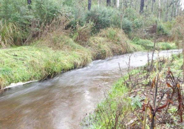
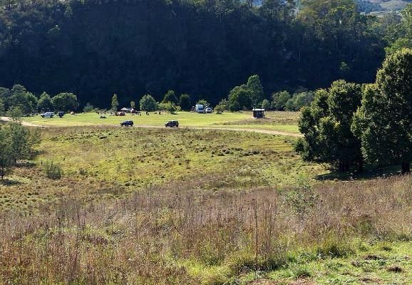
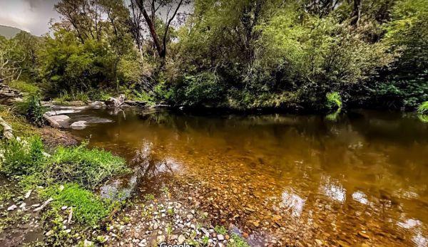
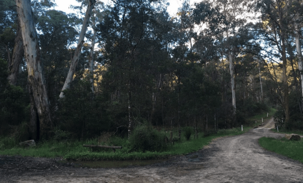
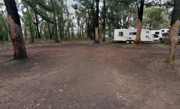
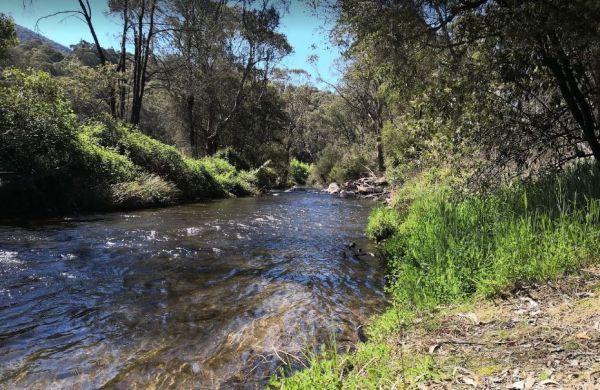
From the 25 Mile Creek Camping Ground, it's a steep walk to get to the Big River, with dinner waiting to be caught if your a fisherman, otherwise it's another rough bush campsite. 25 Mile Creek Camping Ground
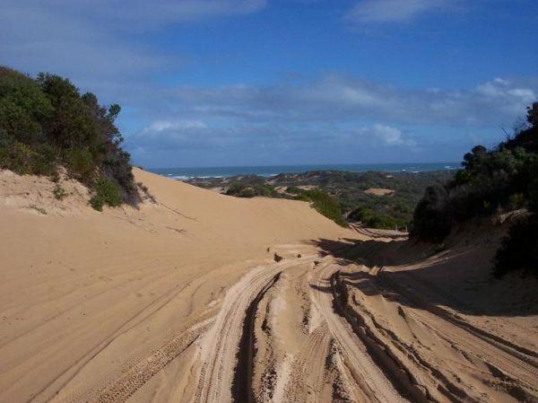
Getting to the 42 Mile Crossing Campground is recommended 4 wheel drive, so don't try to get to this area with a two wheel drive, unless it's a motorbike that is. hahaha
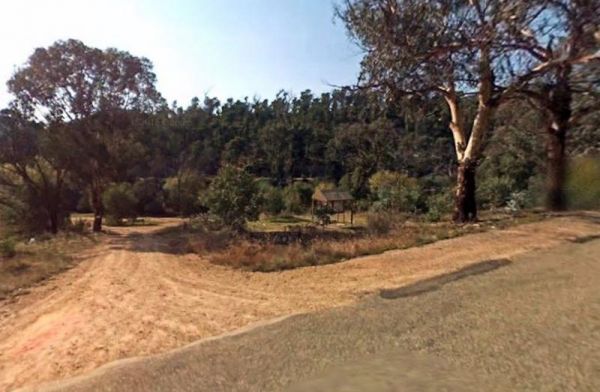
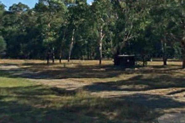
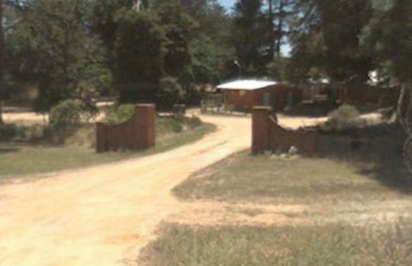
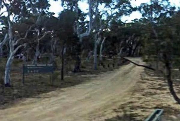
Entrance to the 42 Mile Crossing Campground
42 Mile Crossing Campground location ...
Read More...
Ada River Camping Area
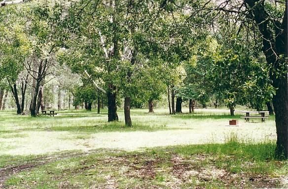
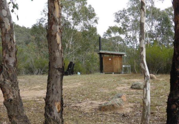
The Ada River Campground is isolated and quiet, and it's distance from the Princes Highway deters most overnight travellers. This campsite is set among tall gum trees with plenty of room for your caravan to spend a pleasant day or two. You have drop toile ...
Read More...
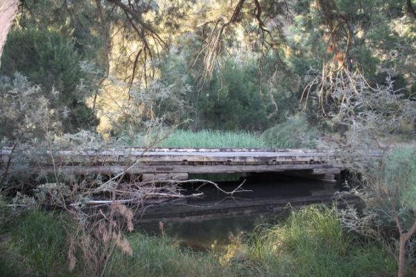
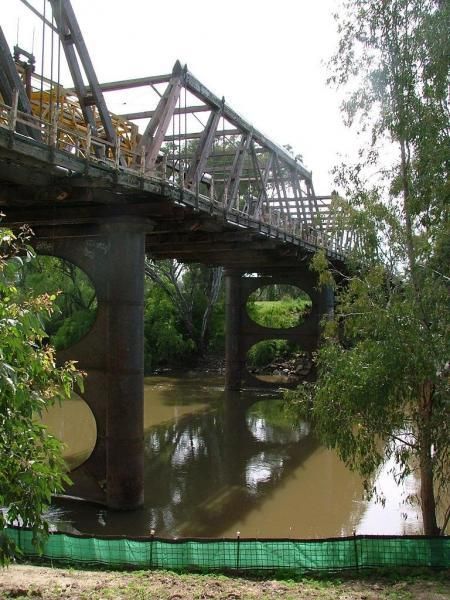
Algebuckina Bridge
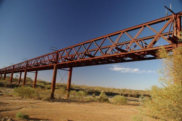
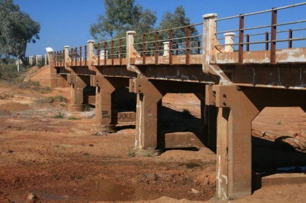
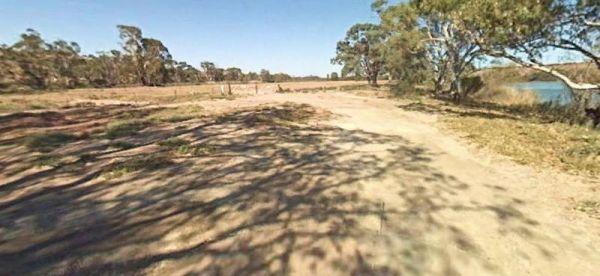
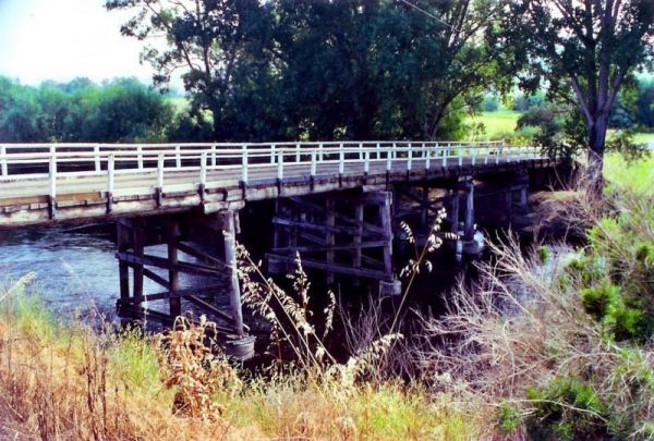
The Algebuckina Bridge has lots of places to select from some with low trees, you will need your levelling blocks for most of the sites. 4X4 vehicle prefered transport for this remote local.
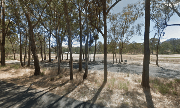
Entrance to the Algebuckina Bridge
Algebuckina Bridge locati ...
Read More...
Andersons Camping Area
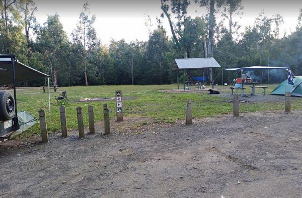
Andersons Garden Camping Area is located within the Mount Disappointment State Forest, with the Sunday Creek running along this campground, it's a nice place for a tent camping adventure.
Entrance to the Andersons Camping Area
Andersons Camping Area l ...
Read More...
Andersons Garden Camping Area
The Andersons Garden Camping Area, the toilets are as clean as a drop toilet can be. There are a lot of mud tracks and roads to explore. There is a nice little creek for the kids to paddle in. The campground is now boarded off so you won't be able to get ...
Read More...
Anglers Rest Campground Area
When stopping at the Anglers Rest Camping Area, is the first of many river access areas from Anglers Rest. There is a drop toilet, with not a lot of level ground to camp at, but you can walk over to the Blue Duck Inn for a bite to eat.
Entrance to the An ...
Read More...
Angusvale Camping Area has plenty of places for your camper trailer plus, there is a Ranger on duty in the area also, you can ask about some of the Old Gold Mining ventures that took place not too far away from here.
Angusvale Camping Area
Angusvale C ...
Read More...
Anna Creek Siding
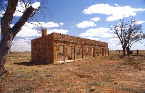
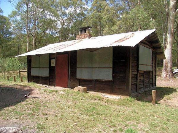
At the Anna Creek Siding you'll see some old buildings that are in quite reasonable shape, and a tent can be pitched inside them as well as the chimney used as a cooking area if needed. Anna Creek Siding location map
Annya Camping ground is not quite a Rough Bush Camp, there are a few picnic tables to choose from, and you can pitch your tent pretty well anywhere and enjoy the sounds of the Great Australian Outdoors. Annya Campground location map
The Apex Beach Camping Area has good fishing right next to your campsite on the banks of the mighty Murray River Victoria side, and opposite the NSW town of Tocumwal. Apex Beach Camping Area location map
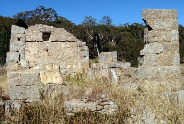
The Appealinna Ruins is an interesting spot to spend a few minutes looking over what's left of the foundations. The ruins are on your left hand side when you reach the roundabout at the end of the road.
Appealinna Ruins 360
Entrance to the Appealinna ...
Read More...
The Archers Crossing Camping Area (Northside) is a basic campsite, with some fireplaces and mobile phone reception. The bush camp is on the banks of the Condamine River where you might be able to catching a fish for dinner.
Archers Crossing Camping Area ...
Read More...
The Archers Crossing Camping Area (Southside) has mobile phone reception and some fireplaces, bbqs and picnic tables and some shade trees located on the banks of the Condamine River. You might like to pop your kayak into the river and try to catch a fish ...
Read More...
Avoca Lions Park has free Camping overlooking the Avoca River its a beautiful place to stop and unwind. The kids can play on the playground and you can sit by and cook dinner on the Barby, or have a crack at fishing in the nearby Avoca River.
Entrance to ...
Read More...
Aysons Reserve is a great free camping spot, is not bad for an overnight stay or several days with a caravan or tent. This site gets quiet busy during public holidays, there are public toilets and a boat ramp right on the Campaspe River, and you are permi ...
Read More...
The Babinda Rotary Park Campground has picnic tables, rubbish bins and a toilet block a blackwater dump point next to it, there is also a potable water tap in the shower room. The park is on the banks of the Babinda Creek with plenty of room to park all s ...
Read More...
Baileys Rocks Camping Area is a great camping spot, it's isolated and secluded, with a very rough corrugated road leading in. There are picnic tables and some fire pits plus public drop toilets. This is a shady forest campsite, amongst huge trees and inte ...
Read More...
The Baladjie Rock Camping Area has plenty of spots for camping, camper trailers and caravans. This is a popular picnic spot for locals and visitors, and there are fire pits, and a public toilet here. Shade is limited, and there are no rubbish bins, so ple ...
Read More...
The maximum number of stays at any of the Balgal Beach Foreshore Reserve Camping Area sites is once per week. Council officers routinely visit camping areas to check on how long people have stayed. If it is found that campers are not complying with this p ...
Read More...
The maximum number of stays at any of the Balgal Beach Foreshore Reserve Camping Area sites is once per week. Council officers routinely visit camping areas to check on how long people have stayed. If it is found that campers are not complying with this p ...
Read More...
Balla Balla Inlet
The Balla Balla Inlet has quite a few suitable places to stop, and maybe take a few extra days rest all along the Balla Inlet. Balla Balla Inlet location map
Balley Hooley - Snowy River National Park has no bookings required, camping is strictly on a first in first-served basis Balley Hooley - Snowy River National Park location map
The Ballinyoo Bridge Camping Area is a rough bush camp available on both sides of the Carnarvon Mullewa Rd, It would be a good idea to scout it out first before committing your van to it.
Note: This campsite is located on the banks of the Murchison River ...
Read More...
Barmah Lakes Camping Area is close to the Murray River and is great for Kayaking, Photography, Fishing, Swimming, and there is a boat ramp as well. Barmah Lakes Camping Area location map
Baw Baw National Park - Aberfeldy River Camping Area is within easy walking distance to the Aberfeldy River where you can catch a trout for dinner, or try your hand at panning for gold. This campsite set amongst gumtrees and not a bad place to camp for a ...
Read More...
The Beggs Bend State Forest Camping Area has quite a few places to camp at, all along this stretch of dirt road which follows the Murray River for a bit.
Entrance to the Beggs Bend State Forest Camping Area
Beggs Bend State Forest Camping Area locatio ...
Read More...
Entrance to the Bemboka Rest Area Bemboka Rest Area location map
Bendeela Reserve Camping Area
The Bendeela Reserve Camping Area is a nice spot on banks of the Kangaroo River. Turn left just before the power station. Note: The dump point is located at the first toilet block. Bendeela Reserve Camping Area location map
The Bendemeer Apex Park Rest Area is a nice spot near to local services, with lots of picnic tables both under shade and under cover. Garbage bins and toilets are there, along with picnic tables and a bbq, plus a completely fenced children playground. The ...
Read More...
Bendethera Valley Camping Area you can test out your 4x4 on some of the tracks or simply enjoy the river and the activities available on it.
Bring your own firewood, and check the water levels before crossing the creeks.
Bendethera Valley Camping Area l ...
Read More...
If camping at the Bently Plain Camping Area, there are two cabins in the area to investigate, it's also well worth carrying your Camera with you if you check them out.
Entrance to the Bentley Plain Camping Area
Bentley Plain Camping Area location map ...
Read More...
When visiting the Beresford Railway Siding Ruins it is recommended to take extreme care when visiting these places, have plenty of water and spare fuel with you, and let someone know you will be heading in case of an emergency.
Beresford Railway Siding R ...
Read More...
From the Bethune Park Camping Area you can go Fishing, Boating, Kayak, and walks along the lake shore are all available from this popular spot. Entrance to the Bethune Park Camping Area Bethune Park Camping Area location map
The Big Bend Camping Area has mobile phone coverage, lots of fishing spots and a few level spots along the Murray River to camp at all with rivergums, and a riverfront view. Entrance to the Big Bend Camping Area Big Bend Camping Area location map
Big Billy Bore Camping Area
If you intend to camp at the Big Billy Bore Camping Area, is an awesome experience in the desert, be prepared for hot days and cold nights and make sure you are self sufficient with plenty of drinking water.
P.S. It will shake your van quite a bit on the ...
Read More...
If camping at the Big River Camping Area it's well worth you time to get out your fishing rods and trying your luck at catching dinner. Big River Camping Area location map
Big Toms Beach Camping Area is just a few Kilometres from Cobram and on a nice sandy bank of the Murray River which is good for swimming. This is a lovely open area, with lots of room for several vans. Big Toms Beach Camping Area location map
The Bilyuin Pool Camping Area is a quiet place to camp, and well away from the highway with reasonable level ground to camp on next to the Murchison River. The river water level varies depending on season and drought conditions. Normally there is plenty o ...
Read More...
At the Binalong Rest Area you can take a swim in the swimming pool, have a BBQ or let the kids play on the playground, perhaps take a stroll along the streets and checkout the neighbourhood.
Entrance to the Binalong Rest Area
Binalong Rest Area locati ...
Read More...
Blackbird Hut (Kelly's Hut) Campground
The Pickerings Flat Camping Area still has a historic cattleman's hut in use today by Parks Victoria, it's used to maintain the other huts and parks in the area. This campsite comprises of a large grassy area, with plenty of camp sites to choose from. You ...
Read More...
Blue Pools Camping Area
Blue Pools Camping Area, as the name suggests, a nice pool of water set in the Briagolong State Forest. There is a public toilet onsite and the Freestone Creek runs close by for those interested in fishing or exploring.
Blue Pools Camping Area
Blue Po ...
Read More...
Blue Range Creek Camping Area
Blue Range Creek Camping Area is nice little campground on the river, with drop toilets located in the day area across the road. This campground is a relatively quiet spot to camp and is 20 min from Mansfield. Its set amongst tall gum trees that offer sha ...
Read More...
Visiting Bluff Creek Camping Area during springtime, is a great time to take the walking trail to see the Bluff Falls, there is only 5 suitable spots for caravans. Bluff Creek Camping Area location map
Bluff Hut Camping Area
Bluff Hut Camping Area is great for overnight trekkers, or just a stop over for The Bluff summit. There is a drop toilet and a firepit with a water tank nearby. This is a tent based or 4wd vehicle camping spot. From here summit and grab a photo or two of ...
Read More...
The Boltons Green Campground is a nice free campsite at Cockle Creek is a beautiful place with best scenery and beach with shallow water and a public toilet. Entrance to the Boltons Green Campground Boltons Green Campground location map
At the Bombay Reserve Camping Area, small caravans or camper trailers are best suited for this spot. It's about 100 metres or so to the Shoalhaven river for those fishing enthusiasts out there, which is a bit too far and difficult to carry the kayak.
It' ...
Read More...
The Bonshaw Weir Camping Area does not allow fishing and swimming within 200m of weir is prohibited, but is OK once you pass the 200 metre mark in either direction. Entrance to the Bonshaw Weir Camping Area Bonshaw Weir Camping Area location map
The Booberoi Weir in on the Lachlan River offering a nice place to stop at and test your kayak and fishing gear, and trusty camera. Booberoi Weir Camping Area location map
Bourkes Bend State Forest Camping Area
Bourkes Bend State Forest Camping Area location map
Bradys Lake Camping Area 7 Day Limit
Bradys Lake Camping Area camping is only allowed in designated areas, some of the best brown trout fishing is to be had from this lake. Entrance to the Bradys Lake Camping Area Bradys Lake Camping Area location map
At the Brandons Bend River Reserve Rest Area you crop your Kayak in the Murrumbidgee River and go for a short paddle or drop a line in and try and catch dinner, this is quite a large off road site with plenty of opportunities to park.
Entrance to the Bra ...
Read More...
At the Brentnalls Beach Camping Area, you will need to bring everything you need for your stay, and take away your rubbish with you when you leave. This is a real bush camp with fishing available from your doorstep.
Brentnalls Beach Camping Area location ...
Read More...
The Bretti Reserve Camping Area is an open area with plenty of space to set-up camp next to the Barnard River, so catching dinner will be on your agenda. Entrance to the Bretti Reserve Camping Area Bretti Reserve Camping Area location map
Phone first to ask Permission to Camp Here Entrance to Broadford Bowls Club Broadford Bowls Club location map
Brodies Camping Area has plenty of places to camp and it's for the kayak to be taken off the roof rack, and explore some of the lake, take your camera and fishing gear with you to capture that Giant Redfin. Brodies Corner Camping Area location map
The Bromus Dam Camping Area is a good place for a stop over, with public toilets, picnic tables, and fire pits and shady trees with heaps of room for caravans to park. For the fishermen, there is a dam not too far away with yabbies in it.
Entrance to the ...
Read More...
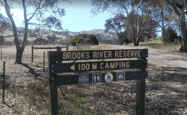
The Brooks River Reserve Camping Area can be dusty during the summer months and very quiet and peaceful, it's a lovely spot with a long drop toilet. It's a bit of a steep 200 metre walk down to the Goulburn River, but not bad one there.
Brooks River Rese ...
Read More...
Bruces Beach Camping Area is another secluded rough bush camp with a nice waterfront view, from the campsite you choose. Bruce's Beach Camping Area location map
The Bruces Bend Camping Area has Non-flush toilets and picnic tables and a boat ramp all close to the Murray River. Bruces Bend Camping Area location map
Buckety Plain Camping Area is a great campsite and not far from the Bogong High Plains road. There is abundant open space where you can pitch tents, or set up a camper trailer. At this campsite you'll find picnic tables and fireplaces along with a single ...
Read More...
The Buckland River Camping Area has plenty of fishing spots to choose from along it's banks, and for those with kayaks you will have a bit of fun also. There are a few camping areas along the Buckland River, it's best to Boil the River water before drinki ...
Read More...
Budj Bim Campground is a lovely place to stay with the treat of flushing toilets and warm water showers, picnic tables and bbq, located in the Mount Eccles National Park in Victoria, Australia, 270 km west of Melbourne, and is located inside the national ...
Read More...
Bummaroo Ford Campground
When stopping at the Bummaroo Ford Campground you can hike along the Abercrombie River, check out a few swimming holes and fishing spots, drop your kayak in and take a paddle along the river.
Generators are not permitted in this campground. Bring your ow ...
Read More...
The Buntine Rocks has i nice easy climb rock with good views. Road in is a bit rough, probably need AWD or keen 2WD with some clearance. A picnic table is the only facility, with loads of room an amazing wildflowers. This is a rough bush camp with no faci ...
Read More...
Bunyip Hole Reserve Camping Area
The Bunyip Hole Reserve Camping Area is a bush camp on the banks of the Murrumbidgee River with plenty of shade and fishing opportunities to catch Yellowbelly and Murray Cod. Bunyip Hole Reserve Camping Area location map
The Burnt Bridge Camping Area is an amazing place, with easy access to the river, good for fishing. There are 2 separate drop toilets, one in the main area, and the other further down the towards the end of Burnt Bridge.
Most of the camping areas are of ...
Read More...
Burra Rock Nature Reserve Camping Area
The Burra Rock Nature Reserve Camping Area is a day use area with camping allowed. There are some picnic tables, fireplace and a public toilet, and at the base of the Burra Rock is a dam, once used to water the steam trains used for carrying wood back to ...
Read More...
At the Burraga Dam Camping Area you can take a walk around, and you will find some old fish hatchery ponds, and a few other things of interest, so take your camera with you.
P.S. The Burraga Dam is a great place to catch a fish or two while your there. ...
Read More...
Burrowye Camping Area
Burrowye Camping Area is a place to simply unwind and enjoy the sights of the Murray River flowing past. Entrance to the Burrowye Camping Area Burrowye Camping Area Location Map
Bushy Parker Park Rest Area 48 Hour Limit
The Bushy Parker Park Rest Area has flushing public toilets and a blackwater dump point, water taps connected to town water, picnic tables, bbqs next to a beautiful creek. The local store and police station are just down the road. Understandably this is a ...
Read More...
Buttercup Creek Camping Areas (Campgrounds 1-5) has 5 different campground locations, ranging from 2 to 20 suitable campsites in each. Plenty of 4x4 driving tracks to explore from your base camp, you can also checkout the numerous walking tracks in the ar ...
Read More...
Calliope River Rest Area 48 Hour Limit
The Calliope River Rest Area has spacious camping areas on both sides, with the opportunity to sleep the night next to the Calliope River. There are public drop toilets, fireplaces and fishing and it is a popular spot to free camp.
Be Aware: Crocodiles a ...
Read More...
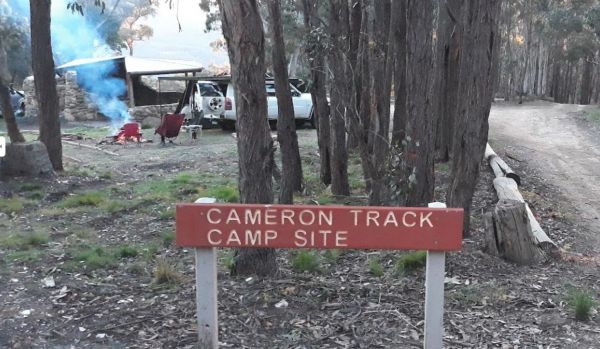
Cameron Track Camping Area
Cameron Track Camping Area is a good place to get your Hiking Boots on, and tackle a few of the walks, don't forget to take your camera with you. Cameron Track Camping Area location map
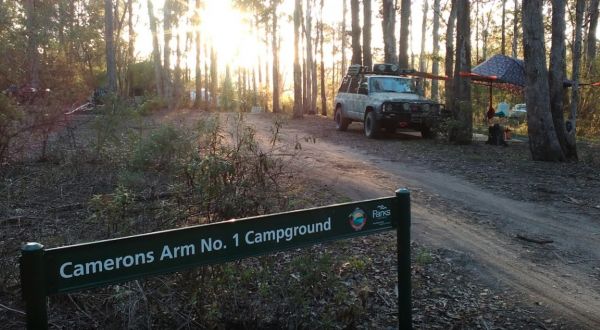
Camerons Arm No1 Camping Area
Camerons Arm No1 Camping Area, is a nice bushy camping area, you will need levelling blocks here, and this campsite is not far from Lake Tyres.
No Camping is permitted within 50 meters of the waters edge.
This is an amazing place dip your kayak in the w ...
Read More...
Water is limited at the Campaspe River Rest Area, the river runs at trickle in the river most times, and it's worth the time to walk over and take a peek. This location is quite a popular rest area, so expect company if you decide to stay overnight.
Entr ...
Read More...
The Carcoar Dam Water Reserve Camping Area has onsite power is supplied for Hair dryers and Shavers the outlets are in the Amenities Block.
Note: The available showers are not heated, so be forewarned if you intend to have a shower in the middle of winte ...
Read More...
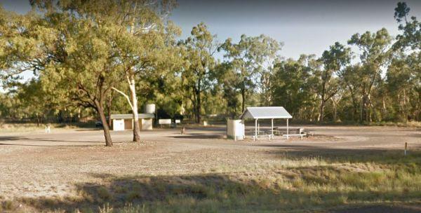
The Caroona Hall Rest Area has a 48 hour stopover limit if you stop here at the Caroona Hall Rest Area, you can walk over to the old church and take your camera with you. (GPS -31.406254,150.425826)
Entrance to the Caroona Hall Rest Area 48 Hour Limit ...
Read More...
Carrathool Bridge Camping Area
The Carrathool Bridge Camping Area is close to the historic Bridge which has a width restriction of 3.2 metres, so keep that in mind if you intended to cross it to the campsite on the north side of the bridge.
Entrance to the Carrathool Bridge Camping Ar ...
Read More...
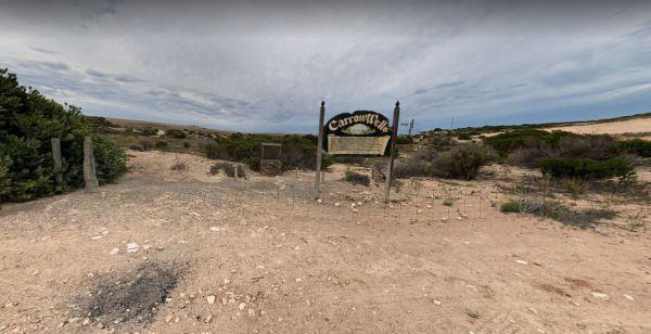
Carrow Wells Campground
The Carrow Wells Campground is very close to a beautiful beach, with a public toilet, and it's a short distance from the North Coast Road, and is a gravel surface.
There is an interesting sign explaining the history of the site and its link to the Aborig ...
Read More...
Carters Mill Camping Area has clean toilets, and it's a quiet spot for a campsite (Not many level spots to choose from). From here, you can walk to waterfalls, you'll find some amazing beautiful views. There are picnic benches and solid fuel fireplaces an ...
Read More...
Entrance to the Cassilis War Memorial Park Camping Area Cassilis War Memorial Park Camping Area location map
The Catamaran Campground and Boat Ramp, is great little spot for camping, boating, fishing and kayaking. There are quite a few nice spots to do an overnighter or two. A handy public toilet and a modern fishing platform for the little ones to try their luc ...
Read More...
Cave Hill Camping Area
The Cave Hill Camping Area has a public toilet, fireplaces with bbq, picnic tables and some nice shady spots to camp. I would recommend a 4x4 if you wish to visit this natural rock feature, it's located approximately 90 kilometres south of Coolgardie, and ...
Read More...
Chaffe Creek Camping Ground
Chaffe Creek Camping Ground is a great campsite spread across 2 sections, there are long drop toilets and a few fireplaces. This camping area is a bit more open than a few others close to this location. You can also catch a fish dinner if you try hard eno ...
Read More...
Chinchilla Weir Camping Area
While at the Chinchilla Weir Camping Area you will enjoy hearing hardly any traffic noise, as the main camping area is set well away from the road. Approx 8 powered sites - donation can be made at tourist info centre for power. Drop the kayak and go for a ...
Read More...
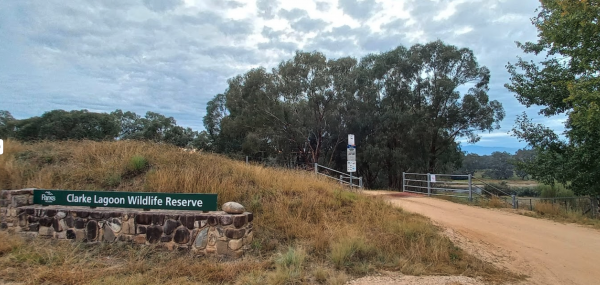
Clarke Lagoon Wildlife Reserve is a peaceful place with lots of level space for family camping with lots of trees for shade, and fast flowing water in the river for a swim or fishing.
Entrance to the Clarke Lagoon Reserve Camping Area
Clarke Lagoon Re ...
Read More...
Entrance to Cobden Free Camp Cobden Free Camp location map
Cobrawonga Island Camping Area
Cobrawonga Island Camping Area location map
Cockburn River Camp Area the rivers water level can be anything from a bunch of pools to a trickle, so make sure you have brought sufficient drinking water with you, if you intend to stay a few days. Cockburn River Camp Area location map
Coochin Creek Camping Area
Coochin Creek Camping Area is a flat, grassy area beside Coochin Creek, ideal for visitors who enjoy fishing and boating and there is also a boat ramp available. Entrance to the Coochin Creek Camping Area Coochin Creek Camping Area location map
Cooee Point Reserve toilets are a real ramshackle affair, well worth taking the camera just to show your friends how you had to rough it while camping. Entrance to the Cooee Point Reserve Cooee Point Reserve location map
Coongan Pool
The Coongan Pool is a lovely, peaceful place for camping and a great place for a swim or picnic. This are permanent water holes, this camping area has limited shade and no facilities, and is well away from the main road. Coongan Pool location map
The Cooper's Creek Rest Area offers plenty of spots to choose from, with time to drop the kayak in and wets its bottom while your there. Entrance to the Cooper's Creek Rest Area Cooper's Creek Rest Area location map
Coopernook Forest Park Camping Area
The Coopernook Forest Park Camping Area has some nice large grassy areas to pitch a tent or park your caravan. Coopernook Forest Park Camping Area location map
Coopers Creek Reserve Campground
Coopers Creek Coopers Creek Reserve Campground location map
The Cooyar Swinging Bridge Park is set well back from the main road. If you need power, walk over to the Pub and grab the key for a small fee. Entrance to the Cooyar Swinging Bridge Park Cooyar Swinging Bridge Park location map
The Copeland Reserve Camping Area has Large grassy areas with plenty of spots available to relax for a day. Entrance to the Copeland Reserve Camping Area Copeland Reserve Camping Area location map
Your rig needs to be fully self contained to stay here. Entrance to Corryong Recreation Reserve Free RV Camping Area Corryong Recreation Reserve Free RV Camping Area location map
Corunna Lake National Park Rest Area
The Corunna Lake National Park Rest Area is not suitable for big rigs, it gets a bit on the tight side if anyone else is already there. Entrance to the Corunna Lake National Park Rest Area Corunna Lake National Park Rest Area location map
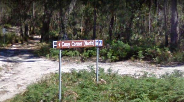
Cosy Corner North Campground
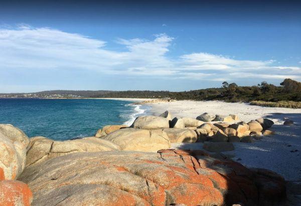
Cosy Corner North Campground is a beautiful camp next to the beach and some great fishing of the rocks, and stunning beach walks that the shell collectors amongst you will also be happy with. Plenty of room to park your caravan and drop toilets available ...
Read More...
Cosy Corner South Campground
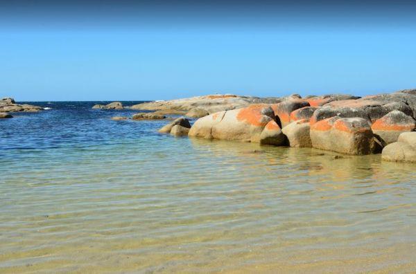
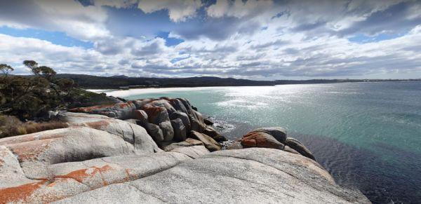
The Cosy Corner South Campground has a fantastic morning view of the Bay of Fires and is popular around School Holiday time, and you will see why, once you walk down to the white sand with orange lichen covered Granite Boulders strewn around. This campgro ...
Read More...
Cotton Tree Creek Camping Area is a beautiful campground! Quite, peaceful, and good facilities. For those of you who enjoy short walks, the Granya Falls (seasonal waterfalls) is about a one Kilometre walk away from here. Plus there is also another 5k walk ...
Read More...
CRB Camping Area
CRB Camping Area is close to the Cobungra River, so have a go at fishing or swimming, and for the more adventurous, grab your kayak and navigate upstream a bit. h3>CRB Camping Area location map
Dando's Camping Area
The Dando's Camping Area is well set up campsite with lots of camping areas and relatively easy access by car. The river is very close and easily accessible. There's 2 clean drop toilets, and some fire pits with bbq swing plates. The Dando's Camping Area ...
Read More...
Dangars Gorge campground
Dangars Gorge campground has public toilets, undercover picnic tables, wood fireplaces with bbq facilities, wood is supplied, and there are some nice places for your caravan to park. Dangars Gorge campground location map
Entrance to the Dargile Plantation Camping Area location map Dargile Plantation Camping Area Location Map
Davons Flat Camping Area
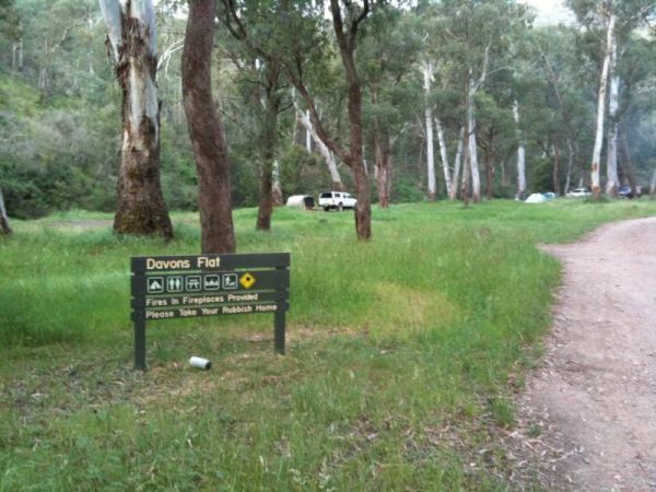
The Davons Flat Camping Area is a beautiful spot alongside the Howqua River and hugely popular. It is part of the Howqua Hills Historic area and just next door to Sheepyard Flats another very popular camping area. This area was used for gold mining, so if ...
Read More...
Dead River Beach Camping Area is great when it's not raining, if you're unfortunate and it dos rain, the whole camp gets flooded. Apart from that it's a nice place to stay for an hour or two on the banks of the Murray River.
Dead River Beach Camping Area ...
Read More...
The Delegate River Camping Area and is a beautiful little campground with approximately 6 suitable areas to camp at. There are fire pits with bbq plates, a long drop toilet. As the name suggests, this camping ground is next to the Delegate River, so don't ...
Read More...
The Diana's Basin Camping Area is another sandy beach within easy walking distance of your camp, you can try and catch a fish for supper. Entrance to the Diana's Basin Camping Area Diana's Basin Camping Area location map
Dicks Bend Camping Area
If going to the Dicks Bend Camping Area, you should bring everything you need to make life comfortable, and take away your rubbish when you leave. Dicks Bend Camping Area location map
You must be fully self contained to camp here. There are plenty of drive through sites, and its an easy walk to pub and main street. Entrance to Dimboola Recreation Reserve Dimboola Recreation Reserve location map
The Ditchfield Camping Area is a great campsite, it has drop toilet and hut with a fireplace. There are a few of the hiking trails that might be of interest. Ditchfield Camping Area location map
The Dogwood Creek Rest Area is just a short walk to the creek to drop a line in and try your luck, or Pop the Kayak in and take it for a quick explore of the area. Entrance to the Dogwood Creek Rest Area Dogwood Creek Rest Area location map
Doolans Bend Camping Area
The Doolans Bend Camping Area has the Murray River at your doorstep, and all associated water activities at your pleasure are available here. Doolans Bend Camping Area Doolans Bend Camping Area location map
Doolena Gorge Camping Area
The Doolena Gorge Camping Area is a really nice place to visit for a day or two. Make sure you have your camera handy at all times. This campsite is approx 41 kilometres north of Marble Bar on the Marble Bar-Port Hedland Road. The turnoff is very easy to ...
Read More...
The Duaringa Campgrounds is a popular spot with very good amenities provided by the local council. You should pop a donation at the visitors centre, to help offset the cost of running the hot showers and free drinking water.
Entrance to the Duaringa Camp ...
Read More...
Entrance to the Dunalley Hotel Camping Area Dunalley Hotel Camping Area location map
The Dundas Rocks Camping Area has some picnic tables in the shade, and fire pits with bbq and some rubbish bins. There is not a lot of level ground for any sort of camping. There are natural rock formations, the ruins of the town water supply, the town it ...
Read More...
Edi Cutting Camping Area has crystal clear water in the King River, and plenty space for camping. There’s two toilets available and this place gets very busy over holidays. This campsite is really a nice place for the kayak, and a bit of fishing or simply ...
Read More...
From the Edward River Camping Area you can catch dinner from the Edward River or test your kayak skills, or simply take a dip in the water with your GoPro Camera. This is a very well set up place to camp. Edward River Camping Area location map
Ellenborough Reserve Camping Area 14 Day Limit
The Ellenborough Reserve Camping Area is a nice grassy area where the Hastings and Ellenborough Rivers meet.
It's a rather nice spot to spend a few hours or days simply relaxing.
Entrance to the Ellenborough Reserve Camping Area 14 Day Limit
Ellenbor ...
Read More...
The English's Bridge Camping Area is a great campsite by the Campaspe River, with good swimming area near bridge boat ramp. There is plenty of level ground for RV's or caravans. It's best to be self contained if camping here as there are no amenities, and ...
Read More...
The Falls Park to camp here you will need a Permit from local council, you can do this online quite quickly.
Free camping is available between Friday and Sunday 8.00am for self contained campers. The local Sunday market is well worth a visit if you camp ...
Read More...
The Fassifern Memorial Park Rest Area does not a lot to do here apart from take a break from driving, grab a bite to eat and get ready for more driving.
P.S. The Warrill Creek is on the opposite side of the road hidden behind long grass.
Entrance to the ...
Read More...
Entrance to the Finlays Beach Camping Area Finlays Beach Camping Area location map
To get to the Finley Beach Camping Area, turn onto an unnamed Dirt Road at GPS -35.821054,145.554872, Nice spot on the Murray River Entrance to the Finley Beach Camping Area Finley Beach Camping Area lcation map
The Finns Beach Campground has a public toilet, and a few secluded campsites, with a nice sandy beach close at hand, where you can enjoy nice sunsets or have a go at catching dinner.
Entrance to the Finns Beach Campground
Finns Beach Campground locati ...
Read More...
Firth Park Camping Area
The Firth Park Camping Area has some undercover Picnic Tables, there is also a small lake where you can try to catch a fish or two. Not many places for caravans, but plenty of room for tents, there are 4 long drop toilets, fireplaces with swivel bbq plate ...
Read More...
Fishbone Flat Camping Area is a nice spot along the Arnold Creek, with a few fireplaces and no other facilities to grace this campsite. Fishbone Flat Camping Area location map
The Fishermans Rest Riverside Reserve is just out of Mitchell town, there is a public drop pit toilet, picnic tables and rubbish bins. There are plenty of shady spots to camp under, and it's only a short walk to the Maranoa River, so fishing and kayaking ...
Read More...
Fitzgerald Bay Camping Areas
The Fitzgerald Bay Camping Areas has quite a few spots available in designated areas, look for the signs pointing you in the right direction to the campsites. Fitzgerald Bay Camping Areas location map
Five Mile Reserve Camping Area
If your up for a bit of a hike from the Five Mile Reserve Camping Area you can head off to the Murrumbidgee Northern Canal with fishing gear and camera. Entrance to the Five Mile Reserve Camping Area Five Mile Reserve Camping Area location map
Flat Rock Camping Area is a nice spot with a decent amount of wildlife. Watch out for wallabies, roos and wombats on the side of the road if driving In the evening or night. Great campsite with lots of camping space to base yourself and go exploring from ...
Read More...
Forges Beach No 1
Forges Beach No 1 can accommodate large vans, and provides excellent camping right on the Murray River. This campsite is a safe place for the kids to swim and is very popular during public holidays. There are long drop toilets at the campground.
Forges B ...
Read More...
The Fountain Springs Rest Area has flushing public toilets, and a water tap (The water is not suitable for drinking).You will find this is a popular spot so if you get there late, you might have a problem finding a place to park your caravan.
Entrance to ...
Read More...
Four Mile Reserve Camping Area
The Four Mile Reserve Camping Area is a great spot on the Barwon River, with flushing toilets, cold water showers and bbqs. This is a large campground with plenty of flat spots to park your caravan. There is a Jetty and a Boat Ramp, for those who like fis ...
Read More...
The Frenchmans Creek Camping Area is a really nice peaceful and quiet camping ground next to the Big River for fishing. There are lots of tracks to explore and heaps of spots to camp and the campsites are better suited to vehicle based camping rather than ...
Read More...
Froam Campground
Froam Campground is a small camping and picnic area on the banks of the Freestone Creek. Visitors can gain access to Blue Pool via the Freestone Creek Walking Track, here you will find a nice swimming hole. Additional campsites are located further along F ...
Read More...
Frys Flat Camping Area
Frys Flat Camping Area is a picturesque campsite with a long drop toilet, and fire pits with the Howqua Hills Historic Walk on your doorstep and it will take you around 1 1/2 hours to complete. The king parrots and kookaburras are overly friendly, so watc ...
Read More...
The Futter Creek Camping Reserve is on level ground is small, beautiful and quiet, and simply perfect for a few nights camping. There are long drop toilets, picnic tables and rubbish bins. The creek offers some fishing and photo opportunities. There is al ...
Read More...
The Gang Gang Gully Camping Area has no rubbish bins onsite, you should take your rubbish home with you. If you want to light a fire, gather only dead wood and don't cut down any trees. Gang Gang Gully Camping Area location map
The Gascoyne River South Branch is a large gravel parking areas with some shade. There are long drop toilets with wheelchair access, some rubbish bins, a blackwater dump point, undercover picnic tables and fire pits. There is also provision for wheelchair ...
Read More...
Geehi Flats Camping Area is a beautiful riverside campsite with public toilets, fire places, shelter and loads of space, and the campground is accessible with a 2WD vehicle if you drive through the Geehi rest area. This is a great spot to camp plenty of r ...
Read More...
The Genoa Rest Area has a General store just over the footbridge, so you can stock up your larders, and access to a public phone box if needed. Entrance to the Genoa Rest Area Genoa Rest Area location map
The Geo Spencer Memorial Rest Area has a 48 Hour Limit for stopovers. There are a few level places to park your caravan under shady trees. Here you will find flushing toilets, an undercover BBQ and some picnic tables and rubbish bins.
Entrance to the Geo ...
Read More...
George Town Visitor Information Centre Rest Area 20 Hou...
Entrance to the George Town Visitor Information Centre Rest Area George Town Visitor Information Centre Rest Area location map
Geraldton Bore Camping Area
The Geraldton Bore Camping Area is on Aboriginal Land, so permits are needed to camp here. This campsite is located on Hunt Oil Road just off the Gunbarrel Highway.
You must contact Department of Aboriginal Affairs for Permit to camp here.
Geraldton Bor ...
Read More...
From the Gilhams Beach Camping Area, you can walk over to the sandy beach and watch the sunset, or take a beach rod and try your luck at fishing. Entrance to the Gilhams Beach Camping Area Gilhams Beach Camping Area location map
If stopping overnight at the Gin Gin Rest Area, you'll find plenty of room for your caravan, public toilets with hand wash basin and picnic tables and chairs, plus a water tap. Entrance to the Gin Gin Rest Area Gin Gin Rest Area location map
Glasshouse Camping Area
The Glasshouse Camping Area is a nice free camp with no amenities. Grab your camera and capture what you see. P.S. No Camping is permitted closer than 50 meters to the water.
Entrance to the Glasshouse Camping Area
Glasshouse Camping Area location map ...
Read More...
Glebe Weir
At the Glebe Weir they hold a Fishing comp on the June long weekend. this is a low cost camp site. There is asphalt all the way to the weir, and plenty of space once you get there.
BRING Your own water and wood for your fireplace plus a long power leads. ...
Read More...
Glen Davis Camping Area
The Glen Davis Camping Area is a great camping spot, stunning scenery and close to hiking trails and a river. Basic camping toilets, fire pits, children's playground, undercover picnic tables, bbqs and hot showers, and lots of native wildlife around the c ...
Read More...
Glendinning Camping Area has plenty of space for you to find that perfect spot to setup camp. There are long drop toilets, views of grampians, and good fishing spots. Entrance to Glendinning Camping Area Glendinning Camping Area Location Map
Glenriddle Rec Reserve Camp Area is a great free camping ground beside Manilla River on the upper limits of Split Rock dam. This is a huge area suitable for all types of camping - caravans, campervans, mobile homes, tents, and there is a boat ramp. There ...
Read More...
Gloryvale Reserve Camping Area is a great spot for a weekend or overnight just to get away. Reasonably level ground for your caravan with concrete fire pit bbq, long drop toilet, and picnic tables. There are fish and yabbies in the Manning River that runs ...
Read More...
This site has flushing toilets, there is a water tank but make sure you boil the water first. A nice grassy area for you to set up camp and the beach nearby for sightseeing and fishing.
Entrance to the Gordon Foreshore Reserve Camping Area
Gordon Fore ...
Read More...
Gordonvale Rest Area
From the Gordonvale Rest Area you can take a walk along the banks of the small creek that runs into the Mulgrave River or be more adventurous and drop the kayak in. Entrance to the Gordonvale Rest Area Gordonvale Rest Area location map
Goulet Bluff Rest Area 24 Hour Limit
The Goulet Bluff Rest Area is a nice open area, with plenty of room for caravans to park here. You need a permit from the discovery centre, or ring the number on the sign. This is a very popular spot, so booking is a must if you intend to stay here.
Entr ...
Read More...
Entrance to the Granite Creek Rest Area Granite Creek Rest Area location map
The Grannys Flat Camping Area has a few 4x4's tracks to check out. There are no built fireplaces at this site, so please use a previous campfire site and clean up afterwards. This is a nice place on the Jamerson River, for those of you who enjoy fishing e ...
Read More...
The Granthams Bend Camping Area is close to town, you only need to simply cross the bridge over the Murray River into N.S.W. This campsite is a rough Bush camp, where you need to bring everything you need, and take your rubbish with you when you leave.
E ...
Read More...
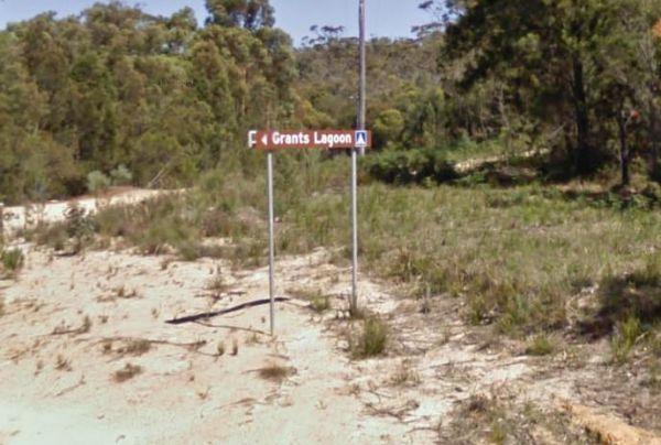
Grants Lagoon Camping Area 30 Day Limit
Grants Lagoon Camping Area is a nice Bush camp with some drop toilets inside the Bay of Fires Conservation Area, with a boat ramp if you need it, plus it's a nice kayaking area as well.
Entrance to the Grants Lagoon Camping Area
Grants Lagoon Camping ...
Read More...
Green Bank Camping Area
To get to the Green Bank Camping Area, follow Cullens Road to the Loop Track to the Murray River, and pick a campsite. Entrance to the Green Bank Camping Area Green Bank Camping Area Location Map
At the Green Hill Lake Camping Area, you can stay for 4-5 days and a permit is need for longer stays. free hot showers and a good toilet facility, bbq, fire pits, a children's playground and lots of rubbish bins. You can swim,kayak and explore the islands ...
Read More...
The Greenough River Camping Area is a bare bones camping site, where you need to haul in everything you need. On a positive note there are lots of level spots for your caravan or motorhome. The rivers water levels vary, depending on the time of the year, ...
Read More...
At the Greens Camping Area, fossicking for Gold is on the list when you visit here, with lots of interesting relics to be seen and captured with your camera. Greens Camping Area 360 view Greens Camping Area location map
The Greens Lake Recreation Area is a lovely place with showers, toilets, bbqs and a Boat Launching Ramp, BUT that means very little if there is a drought, as the lake is very shallow and dries up rapidly. Greens Lake Recreation Area location map
When visiting the Greens Point Camping Area you can pop over to the historic old township of Sofala, it's well worth the short drive from your campsite. Greens Point Camping Area location map
Gulpa Island Precinct Camping Area has plenty of places to pull over and enjoy the scenery.
You might want to check this location first before committing to taking a large caravan in, as the road can be a bit difficult in places.
Gulpa Island Precinct C ...
Read More...
Gum Bend Lake Camping Area 14 Day Limit
The Gum Bend Lake Camping Area has hot showers, rubbish bins, undercover picnic tables and bbqs with plenty of camping places to pick from, fishing, photographic opportunities everywhere and it's about 5km from the town of Condobolin in Central NSW. The G ...
Read More...
Entrance to the Gunalda Rest Area Gunalda Rest Area location map
At the Gunbower State Forest Camping Area has lots of camping spots and very clean and tidy, with long drop toilets, you can take caravans in, the tracks are a bit rough in spots, but passable, and you will be rewarded with a good campsite next to the Mur ...
Read More...
Guttram State Forest Camping Area
The Guttram State Forest Camping Area is on the banks of the Murray River with all water activities at your doorstep. It's a bit on the bumpy side to get their so take care. Guttram State Forest Camping Area location map
The Gwydir River Camping Area is very relaxing and peaceful, with large open areas to park your caravan for a few days, and the Gwydir River at your doorstep asking to be explored. There is an introduced plant you need to keep an eye open for, it's the ti ...
Read More...
Hall Point Camping Area 48 Hour Limit
At the Hall Point Camping Area you can relax and take a sunset walk along the beach with your camera. I'm sure you'll find some interesting things to photograph.
The Hall Point Camping Area is restricted to 48 Hours stopovers for Self contained Motorhome ...
Read More...
The Hamilton Rest Area is opposite the Bicentennial Park, is a beautiful place with apple and pear trees, public toilet and showers, laundry, dump point and potable water. where you'll find a public toilet, undercover picnic tables and rubbish bins. Or yo ...
Read More...
Hammonds Road Camping Area
The Hammonds Road Camping Area is a nice spot with lot of kangaroos visiting the campsite at night and colourful parrots during the day. There are individual fire pits and lot of benches near your camp, clean toilets and tank water for dishwashing. There ...
Read More...
The Hann River Camping Area may look idyllic, but it's good practice to make sure you have plenty of water and supplies when travelling in outback Australia. This campsite is set back a short distance from the Gibb River Road, a few trees for shade and no ...
Read More...
Happy Valley Landing Camping Area
To get to the camping spots follow Happy Valley Landing Road, you have another 1/2 Kilometre of dirt road to go after the asphalt ends to get to this spot on the Murray River.
Entrance to the Happy Valley Landing Camping Area
Happy Valley Landing Camp ...
Read More...
The Hattah-Kulkyne National Park Camping Area has lovely walks through the Mallee with plenty of bird life and gorgeous flora. It's a semi-desert national park, and very flat with lots of Emus, Kangaroos, Possums etc. There are a a few separate Camping ar ...
Read More...
The Haythorpe Reserve Camping Area has plenty of places to choose from, and you are right on the banks of the Murray River. Entrance to the Haythorpe Reserve Camping Area Haythorpe Reserve Camping Area location map
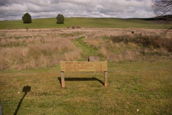
The Henry Angel Flat Camping Area is a nice spot to enjoy a week or two, fishing swimming photography and short walks all on your doorstep. Entrance to the Henry Angel Flat Camping Area Henry Angel Flat Camping Area location map
Heron Bend Camping Area
At the Heron Bend Camping Area you can pop into the pub while your there, and check out the conditions before you head down the dirt road.
Note: Dogs must under owners control at all times.
Entrance to the Heron Bend Camping Area
Heron Bend Camping A ...
Read More...
Hettner Landing Camping Area
When stopping at the Hettner Landing Camping Area you can pop into the Walker Flat General Store and stock up on food, drinks, and fuel, before popping into this camp site. GPS for store: -34.752985, 139.557238 You will find rock rings for fires & tab ...
Read More...
Overnight stays are for fully self contained RV's only at the Highbury Recreational Vehicle Free Stay Area. Note: Annexes that do not require fixing to the ground, and that form part of the RV, are permitted. No Pegs of any type are permitted to be driven ...
Read More...
Hiscocks Crossing Camping Area is situated on the Banks of the Crawford River, with camping permitted only at Hiscocks Crossing, where the public toilets are provided. This is 4x4 country Hiscocks Crossing Camping Area Location Map
The Hogwash Bend Conservation Park is a great place to drop the kayak into the Murray River and paddle upstream a bit, or sit on the large sandy beach and try your luck at catching dinner.
Entrance to the Hogwash Bend Conservation Park
Hogwash Bend Co ...
Read More...
The Holder Bend Reserve and Boat Ramp has a nice concrete boat ramp to pop your kayak into the Murray River and remember to take your camera with you. Entrance to the Holder Bend Reserve and Boat Ramp Holder Bend Reserve and Boat Ramp location map
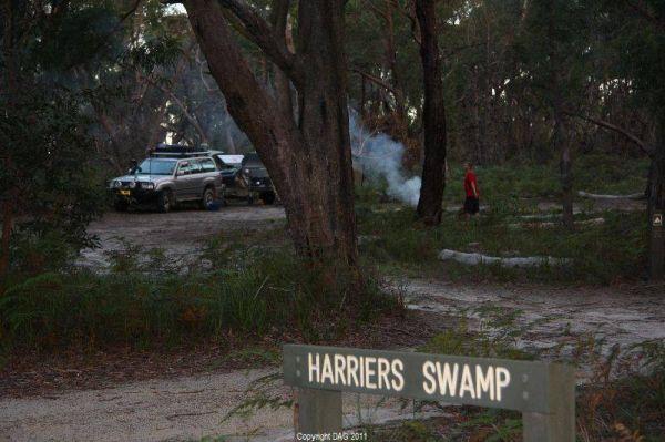
The Holey Plains State Park - Harriers Swamp Campground is 10kms south east of Rosedale. The park is situated south of the Princes Highway between Rosedale and Sale. The main access is from Rosedale, via the Rosedale Willung Road and Recreation Racecourse ...
Read More...
The Horseshoe Bend Camping Area has one long drop toilet, and lots of level ground to park your caravan next to the Murray River. This campsite is good for boating, skiing, and fishing or just plain relaxing. Plenty of spots along the Murray and not too f ...
Read More...
The Horseyard Flat Camping Area has a nice and the stunning walk to the Falls and gorge. There are lots of 4x4 tracks to explore, the lower campgrounds back right onto the Moroka River. Horseyard Flat Camping Area location map
The Hotspur Bridge has a few good fishing spots, and it's on the banks of the Crawford River, with plenty of room to turn around. Bear in mind this place can get very boggy if it rains. Entrance to the Hotspur Bridge Hotspur Bridge location map
Humbug Point Nature Recreation Area
The Humbug Point Nature Recreation Area is close to a beach with fine white sand and a turquoise ocean with brightly coloured red lichen covered rocks. There are a few spots to pull over every now and then along the main road. This spot is not suitable fo ...
Read More...
The Humes Crossing Camping Area is a beautiful spot! There are long drop toilets, wood fireplaces with bbq facilities, and picnic tables, but it's best to bring levelling blocks for your caravan if you intend to camp here. This campground is just a short ...
Read More...
The Hunts Bridge Camping Area has plenty of space and shade next to the Moorabool River West Branch with a deep water hole for good swimming. It's recommended to get there early, as the best camping spots go fast.
Entrance to the Hunts Bridge Camping Are ...
Read More...
Indi Bridge Reserve Camping Area
The Indi Bridge Reserve Camping Area is an absolutely awesome campground with a long drop toilet. This is a nice place for fishing, relaxing and the occasional photograph of the one that got away.
Note: There is an irrigation pump that starts up in dry p ...
Read More...
Italian Flat is a large flat campsite, with one toilet located on the banks of the Upper Dargo River. You will find a couple of small shallow swimming holes on the river and this camp is only 10 min from Dargo. Italian Flat Campground location map
The Jackass Fern Gully Camping Area is a peaceful stop off point to for a day or two and nice flat campsites, with a few walking tracks to take your camera along.
Entrance to the Jackass Fern Gully Camping Area
Jackass Fern Gully Camping Area Location ...
Read More...
James Camping Area is quite close to the Moonee Creek is quite close to this spot. There are fire pits with swinging hot plate and long drop toilets with plenty of shade to park. James Camping Area Location Map
The James Price Point Camping Area has four cliff top campsites, there are some fireplaces and cliff top view of the open ocean. Access to the beach is via 4x4 and can be a bit tricky, it has also been reported that getting off the beach can be a bit diff ...
Read More...
The Jane Duff Highway Park Rest Area has a historical marker dedicated to Jane Duff, one of three Duff children who in 1864 that was found by an Aboriginal tracker, after being lost for nine days in the bush.
There is also a small lake nearby if you fanc ...
Read More...
The Jimmy Bullocks Camping Area is close to the Big River that flows around a bend, giving you plenty of river to explore, without walking too far from your tent. Jimmy Bullocks Camping Area location map
Jingellic Reserve Camping Area is a beautiful spot right on the Murray River, free camp, with gumtrees offering shade and quite a few spots to camp at there are some rubbish bins, the toilets and showers are available at the back of the pub across the roa ...
Read More...
Jokers Flat Camping Area
The Jokers Flat Camping Area is a nice campground next to the Big River, time to take the kayak off the roof and dip it in some water. Entrance to the Jokers Flat Camping Area Jokers Flat Camping Area location map
The Jones Camping Area has a public toilet, and some fireplaces, and is located next to the Holland Creek, so fishing for trout is a possibility, and there are plenty of photographs waiting to be taken here. Jones Camping Area location map
The Jounama Creek Camping Area, has plenty of riverbank areas for camping on with your caravan. There is a long drop toilet, fire pits and the Jounama Creek has crystal clear water, with Rainbow and Brown Trout waiting to be caught. You will also see cock ...
Read More...
Karalee Rocks Camping Area 72 Hou Limit
The Karalee Rocks Camping Area is a nice place to stay, there is a flushing toilet and an RV black water dump point, picnic tables and fire pits. You can swim in the dam, or catch a feed of yabbies. The camping area has lots of shade to park your caravan. ...
Read More...
Karri Track Camping Area
The Karri Track Camping Area, there is a drop toilet and a few picnic tables and fireplaces provided.No bookings are required here and the camping area is off Old Avoca Road on the Karri Track, it's a well-graded unsealed road.
Note: This is a first in g ...
Read More...
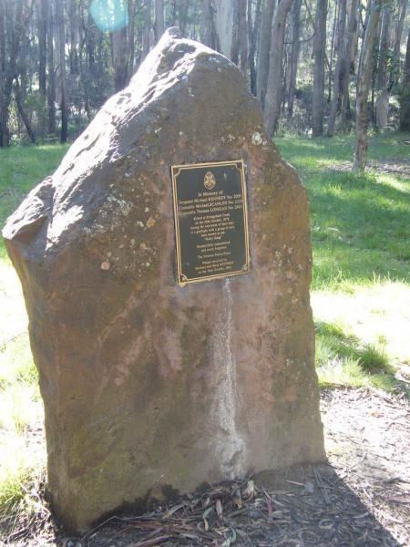
The Kelly Tree Stringybark Creek Camping Area, has public toilets, picnic tables and fire pits, and plenty of space to set up camp. This campground is located where Ned Kelly's gang murdered 3 Police officers.The names of the fallen officers is listed bel ...
Read More...
From the Kempton Rest Area you can take a short walk or get your bikes off the back of the van, and have a short sightseeing trip around town, then settle in for the night.
There is a Tavern with meals and takeaways within walking distance and that the K ...
Read More...
Kennedys Reserve
The Kennedys Reserve is next the Murray River with plenty of campsite opportunities. You can drop your kayak into the river and go for a paddle, or try out some riverbank fishing, or simply kick back and relax.
Entrance to the Kennedys Reserve
Kennedy ...
Read More...
Kentish Park Camping Area - Permanetly Closed
NOTE: Kentish Campground has Permanently closed, there are no longer toilet facilities at this site. Parks & Wildlife Tasmania have taken over.
The Kentish Park Camping Area has a boat ramp is located just below the toilet block area, there are plent ...
Read More...
The King Hut Camping Area has the King River close at hand, for the Trout fishermen out there. A normal 2wd car can get here in the drier months. King Hut Camping Area King Hut Camping Area location map
The King River Rest Area is close to the road so expect some noise, two large tanks with some potable water is onsite, undercover picnic tables and fireplaces available, and for the more adventurous, you can take a short walk to Leech Lagoon.
Entrance to ...
Read More...
King Street Oval Rest Area 24 Hour Limit
Entrance to the King Street Oval Rest Area King Street Oval Rest Area location map
Kings Billabong Lookout has a loop track for you to stretch your legs, it's roughly a 200 meter walk to the lake. There are some undercover picnic tables here. Entrance to the Kings Billabong Lookout Kings Billabong Lookout location map
The Knockwood Reserve Camping Area is a good spot to blow the dust off your kayak and do some exploring. The campground is situated on the banks of the Gaffneys Creek, with plenty of grassy campsites to choose from.
Entrance to the Knockwood Reserve Camp ...
Read More...
Koriella Rest Area is just off the main road with plenty of shade and a place to it down and enjoy a picnic. Entrance to the Koriella Rest Area Koriella Rest Area Location Map
Kroehns Landing
Kroehns Landing is on the banks of the Murray River and a bit on the bumpy side of things, when trying to find level ground. Entrance to the Kroehns Landing Kroehns Landing location map
Kurrajongs Camping Area
From the Kurrajongs Camping Area, you can walk to the Mt Lawson Summit (1,041m) and generally enjoy the area. Entrance to the Kurrajongs Camping Area Kurrajongs Camping Area location map
The Kurth Kiln Picnic and Camping Ground is a place for you to chill and relax, walk around the nature along one of the walking tracks found here. There are plenty of good flat spots to pitch tents. this is a lovely little spot close to Melbourne, with go ...
Read More...
Kyffins Reserve Camping Area is a great place to unwind, and use your kayak for a paddle around, or fishing for Yellow Belly and Murray Cod. From your campsite you will get to see lots of birdlife and great views of Lake Mulwala. You're going to be spoilt ...
Read More...
Lagoons Beach Camping Area
The Lagoons Beach Camping Area is a safe place for a paddle for the kids, fishing over on the main beach. There are multiple campsites ranging from quite open to secluded in this popular location. There are long drop toilets, beautiful shells to be found ...
Read More...
Lake Albacutya Regional Park Camping Area, avoid travelling here on public holidays, as this place can get jam packed with dirt bikes & loud generators. There are flushing toilets, cold shower facilities, and a boat ramp to a lake that's been dry for ...
Read More...
At Lake Barrington Camping Area you can pick your spot from a large grassed area surrounded by large trees. Walk down to the boat ramp and enjoy the scenic view over the lake, or drop a line in and see if there biting today.
Entrance to the Lake Barringt ...
Read More...
The Lake Cobbler Camping Area can be accessed in a conventional 2WD as far as Bennies in dry weather only. Once there you'll find a fairly large gravel surface. Be prepared with warm clothing and sufficient supplies, as the weather conditions rapidly chan ...
Read More...
The Lake Douglas Recreation Reserve road in, past the quarry is very corrugated that leads to a large camping area. The camping area is suitable for caravans that have levelling blocks with them. There is one long-drop toilet, picnic tables and fire pits ...
Read More...
Lake Elingamite Camping Area
The Lake Elingamite Camping Area is a fantastic campground on the lake of Elingamite. There is plenty of slightly sloped land and some levelled spots suitable for RV’s and caravans under shady and mature cypress pines plus some native trees.
The public ...
Read More...
Lake Gairdner Camping Area is a nice spot with amazing view towards the lake and this campsite is great for relaxing, fishing, playing with the kayak etc. But be sure to bring everything you need with you.
Note: The camp area can flood with greater than ...
Read More...
The Lake Johnston Camping Area camping ground is reasonable level for your caravan. There are fireplaces with bbq plates and a few trees for shade and quite close the salt lake itself.
Entrance to the Lake Johnston Camping Area
Lake Johnston Camping A ...
Read More...
Lake Lascelles Rest Area is a great place to free camp around the lake with shady spots right next to the water and brilliant sunsets across the lake. There are toilet and shower facilities, both powered and unpowered sites, a washing machine is available ...
Read More...
Lake Lonsdale Camping Area
The Lake Lonsdale Camping Area is an awesome free campground, there is 4 different campgrounds. This particular campground has a boat ramp and toilet facilities, and plenty of room to camp. Please Note: There are also NO CAMPING areas throughout the Natur ...
Read More...
Lake Mackintosh Camping Area location map
Lake Meran Camping Area
When camping at the Lake Meran Camping Area, water in the lake varies from nothing to full, so fishing is not an option here hahaha. Lake Meran has an Honesty box Fees/Donations used to upkeep of lake facilities and improvements to foreshore:
Entrance to ...
Read More...
Lake Parangana Camping Area
At the Lake Parangana Camping Area you can relax with a fishing line in your hand, grab your kayak and go explore the lake, blow the dust off your camera and take some unforgettable scenery.
Entrance to the Lake Parangana Camping Area
Lake Parangana C ...
Read More...
The Lake Ratzcastle Camping Area is an awesome little location right next to the lake. There are two flushing toilets, tank water and a solar powered shower, and lots os campsites to choose from. Maybe you would like to try your luck at catching a Yabbie ...
Read More...
Lake Wyangan Picnic Area 72 Hour Limit
When staying at the Lake Wyangan Picnic Area, you will find some camping spots for your caravan close to the lake with some trees for shade. There are some picnic tables, bbqs and flushing public toilets with cold showers, plus the occasional got and peac ...
Read More...
Lalgambook Picnic Area was once considered the richest alluvial gold-field in the world. Checkout the Old Silkworm Farm (GPS -37.014618,144.31176) and a few other archaeological features associated with it.
Entrance to the Lalgambook Picnic Area location ...
Read More...
The Langford West Camping Area has a pit toilet which is open when the park is open and a few designated spots for fires. Langford West Camping Area location map
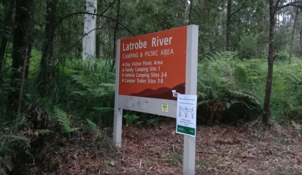
Latrobe River Camping Area
The Latrobe River Camping Area is a great forest campground with some level areas to camp on. There are 2 long drop toilets available and fire pits with bbqs are. This campground is located close to where the La Trobe River and Ada River join. I would not ...
Read More...
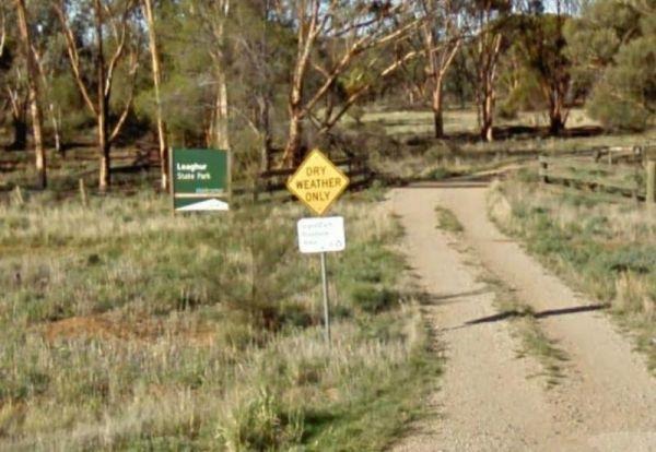
Leaghur State Park Camping Area
The Leaghur State Park Camping Area is a good basic bush camp, with lots of birds, and good bush walking tracks. This is a small campground, 2 to 3 campers most, and is subject to flooding in Winter, so you have been warned. Camping is allowed in both of ...
Read More...
At the Leven Canyon Camping Area if you intend to take the 1.2km circuit walk allow a minimum of 45 minutes, be prepared for 697 Steps and some steep sections in the walking track. Also be prepared for severe weather conditions that change quite quickly, ...
Read More...
Lightning Creek Camping Area
The Lightning Creek Camping Area is a large level and well grassed area with beautiful mountain scenery to set up camp in. There is plenty of room for caravans, clean long drop toilets with wheelchair access, bbqs, picnic tables, large grassy areas with s ...
Read More...
From the Lilydale Falls Reserve Camping Area is best suited to vehicle based tents. It's a short walk to the waterfall, and well worth your time to check it out. Remember to take your camera as you will be snapping off a few shots along your walk.
Entran ...
Read More...
Little Beach Camping Area
The Little Beach Camping Area has a drop toilet, and bbq, and is a back to basics camp, you bring everything you need and take your rubbish away with you. P.S. Good Rock Fishing at either end of the white sand beach. this campsite Gets Noisy around school ...
Read More...
Little Bruces Track Camping Area
Little Bruces Track Camping Area can be hard to find the correct road to turn onto another Dirt road, thats running off the Murray Valley Highway.😂
There are 3 general camping sites, Forges 1, Forges 2, and Little Bruce itself.
Turn Off GPS -35.998578, ...
Read More...
The Little Styx River Camping Area is a beautiful spot near a small trickling river and is a nice restful place to share with a few other travellers. There is a composting toilet and a few fireplaces come bbqs, and plenty of shady trees to park your carav ...
Read More...
Long Beach Camping Area is best suited to vehicle based camping and I'd think twice before committing a large caravan to this spot on the Murrumbidgee River, as it might be a bit difficult to maneuver. Long Beach Camping Area location map
From the Lower Glenelg National Park Camp Area you can visit Princess Margaret Rose Cave. Take a canoe along the river Short scenic bush walks Boat-launching ramps at several points along the river. There are cabins and a camping ground at Princess Margar ...
Read More...
The Lower Liffey Reserve Camping Area is on the banks of the Liffey River, DO NOT ATTEMPT to Take Your Rig Up To The Falls, you will be asking for trouble if you do. The road is narrow and very winding up to the falls car-park.
Entrance to the Lower Liff ...
Read More...
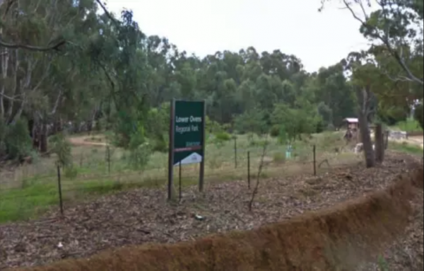
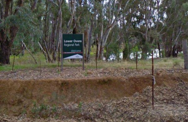
Lower Ovens Regional Park Free Camping Area
Entrance to the Lower Ovens Regional Park Camping Area Lower Ovens Regional Park Camping Area location map
The Macquarie Woods Forest Reserve is a fantastic spot to park our caravan for a few nights to explore Bathurst and has more camping spots than you can poke a stick at. There is a public long drop toilet, picnic tables, fireplaces with bbq facilities, a f ...
Read More...
The Macsland Rest Area is a popular overnight stop for Trucks, you can move off into the scrub if you like and stay overnight there instead if you like. Entrance to the Macsland Rest Area Macsland Rest Area location map
Major Creek Reserve Camping Area
The Major Creek Reserve Camping Area, is a great camp spot if you can get near the water ...it's a bit dusty otherwise with good access for caravans, and depending on what time of the year you stay here especially around Easter, you might hear the scare g ...
Read More...
Majors Creek Recreation Reserve 24 Hour Limit
The Macquarie Woods Forest Reserve has more camping spots than you can poke a stick at. There is a public toilet, bbq, and a small creek nearby.
Entrance to the Majors Creek Recreation Reserve 24 Hour Limit
Majors Creek Recreation Reserve 24 Hour Limi ...
Read More...
The Maldon Historic Reserve Butts Camping Area has shady trees, picnic tables, fire pits and flushing toilets, and the occasional kangaroo. It's around 2-3 KLM out of the centre of Maldon, in its northern suburbs but surrounded by bush, and has proper flu ...
Read More...
Mallanganee Oval Camping Area 24 Hour Limit
The Mallanganee Oval Camping Area is a short walk to Mallanganee Park, which has a picnic table and a few children’s playground bits.
Entrance to the Mallanganee Oval Camping Area 24 Hour Limit
Mallanganee Oval Camping Area 24 Hour Limit location map ...
Read More...
The Mallee Fowl Rest Area is just off the Sturt Highway, with plenty of room to park all sized rigs. There are public toilets, some wood fired BBQ's, and enough room to take your dog for a walk.
Entrance to the Mallee Fowl Rest Area
Mallee Fowl Rest A ...
Read More...
Mannus Camping Area
The Mannus Creek runs next to this site, this is a great base-camp for hiking into the surrounding mountains. Entrance to the Mannus Camping Area Mannus Camping Area location map
The Markeys Beach Camping Area is beautiful and isolated with great campsites with a very isolated beach. This is an awesome place to get away and it's so quiet, and is the sort of location where you really need to use GPS navigation to find your campsite ...
Read More...
The Marlay Point Free Camping has public toilets and an old water tank with water, with camping right on the edge of the beach on a nice grassy area (just near yacht club). This campsite is located approx 18kms from Sale on Clydebank Road, turn off at sig ...
Read More...
The Married Mens Camping Area has a nice new long drop toilet and room for 10+ cars, with good access to running water and dead wood everywhere goes not a lot of tent space available and best suited to 4x4's Married Mens Camping Area location map
Martins Bend Riverside Reserve Camping Area
To find the Martins Bend Riverside Reserve Camping Area, follow Riverview Dr then turn onto Unnamed Road. Use GPS to find it more easily
Note: This site is more suited to smaller rigs or Tent Camping.
Martins Bend Riverside Reserve Camping Area location ...
Read More...
The Maude Camping Area is located just South of the bridge, about 200 mtr off Maude Rd on Nap Nap Rd on dirt road. This is a rough bush camp area on the Murrumbidgee River with enough space for about 6 or so caravans. You are within walking distance to th ...
Read More...
The McClelland Camping Area is a great spot by the river and accessible by 2wd, but best accessed with 4x4's with vehicle based tent camping. You will need to bring everything, and take your rubbish with you, water is available from the Big River, but mak ...
Read More...
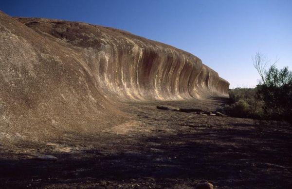
The McDermid Rock Camping Area is an excellent small campground with beautiful walks on McDermid Rock. This rock is a smaller Wave Rock, with an interesting trail to follow when you climb it.
It's an easy road for a single axle caravan making it a perfec ...
Read More...
McKillops Bridge Camping Area
The McKillops Bridge Camping Area has walking tracks, a public toilet and quite limited facilities. The campground is within easy walking distance to the Snowy River, for fishing or swimming over the small rocks.
Entrance to the McKillops Bridge Camping ...
Read More...
McKinnon Point Camping Area
The Mckinnon Point Camping Area is a lovely secluded flat free campsite close to the Freestone Creek, the only downside is that the sunsets early in the afternoon due to the surrounding cliffs. There is easy access from this campsite to river during the s ...
Read More...
The McNamara Park Rest Area is a fairly large campground, surrounded by bush picnic tables, rubbish bins and flushing toilets. This park is suitable for caravans, campers, motorhomes as well as tents and is located on the banks of Wollombi Brook, with a t ...
Read More...
The Melville Caves Camping Area, campground needs a little work for when it rains, water run-offs are a problem and travel through every site. There are fire pits, and long drop toilets here. This is a wonderful large gravel campsite, with its natural sur ...
Read More...
The Mendooran Free Camp is a picturesque area on the river and close to township, beautiful setting with plenty of space for caravans and mobile homes. There are undercover picnic tables, flushing toilets, cold showers, and town water tap behind amenities ...
Read More...
Lake Colac holds Redfin and Carp for those who like fishing, and it's a great place to put your kayak into the water, there is even a boat ramp located here. The campsites is on 6 hectares of land with plenty of places to pitch a tent on grass and quiet c ...
Read More...
Entrance to the Mick Tuck Riverside Reserve Mick Tuck Riverside Reserve location map
The Middle Beach Camping Area, is a walk in backpacking campsite with a public toilet, and some places to pitch a tent, but you will be rewarded with a beautiful open ocean beach at your doorstep. Some of these locations are difficult to find the first ti ...
Read More...
At the Middle Creek Camping Area, you can take a stroll along the Cave Walking Track, but be warned, it's rather steep. Entrance to the Middle Creek Camping Area Middle Creek Camping Area location map
The Miners Flat Camping Area has some fireplace bbqs, and parking space mainly for 4x4 vehicle based camping and a few tents. Miners Flat Camping Area location map
The Mirimbah West Rest Area is a rough bush camp with no facilites, and next to the Delatite River. It's a nice spot to try your hand at fishing, or take a quick stroll with your trusty camera in hand.
Entrance to the Mirimbah West Rest Area
Mirimbah ...
Read More...
Morwell River Free Camping site 1 location map
Mount Beckworth Scenic Reserve - Cork Oaks - Camping Ar...
Entrance to the Mount Beckworth Scenic Reserve - Cork Oaks - Camping Area Mount Beckworth Scenic Reserve - Cork Oaks - Camping Area location map
Mount Beckworth Scenic Reserve - Manna Gums - Camping A...
Mount Beckworth Scenic Reserve - Manna Gums - Camping Area, bring your own firewood and check with the local Visitor Information Centre for details on camping here Mount Beckworth Scenic Reserve - Manna Gums - Camping Area location map
Mount Beckworth Scenic Reserve - The Dam - Camping Area
The Mount Beckworth Scenic Reserve - The Dam, you need to bring your own firewood and check with the local Visitor Information Centre for details on camping here.
Entrance to the Mount Beckworth Scenic Reserve - The Dam - Camping Area
Mount Beckworth ...
Read More...
Mount Franklin Reserve Camping Area
The Mount Franklin Reserve Camping Area you are camping at this Extinct Volcano location is limited, but well worth it, with plenty of walking tracks to explore the area.
Mount Franklin Reserve Camping Area
Mount Franklin Reserve Camping Area location ...
Read More...
Mountain Dam Camping Area has lots of wildlife photography opportunities. There is a boat ramp, a drop toilet and a few fire pits with picnic tables at this campground. You can launch your kayak with ease, but do take it carefully, as there are lots of de ...
Read More...
The Mountain Dam Camping Area has a boat ramp so you can launch your kayak with ease. There is a drop toilet and a few fire pits with picnic tables and this campsite has plenty of campsites to choose from.
Mountain Dam Camping Area
Mountain Dam Campin ...
Read More...
Mt Disappointment State Forest - No 1 Camping Area
Mt Disappointment State Forest - No 1 Camping Area has plenty of spots to choose a campsite from. There are picnic tables, undercover shelters, fire pits and public toilet, plus a few good mountain bike tracks in the area that are worth exploring.
Entran ...
Read More...
The Mt Langi Ghiran State Park Camp Area is a very basic free camping bush site for setting up a hiking or 4WDriving camp base. Entrance to the Mt Langi Ghiran State Park Camp Area Mt Langi Ghiran State Park Camp Area location map
The Murchison State Forest - McMillans Camping Area you need to bring everything you need with you, and remember to take your rubbish to keep this site pristine, and ready for the next camper to enjoy. This is a rough bush camp with a few campsites to cho ...
Read More...
Murray Sunset National Park Camping Area
The Murray Sunset National Park Camping Area is a very basic bush camp and a great place to set up a base camp for four wheel drive touring, bushwalking and camping. Murray Sunset National Park Camping Area location map
The Murtho Forest Landing Campground is very close to the Murray River. This is a basic bush camp and not a bad place to drop a fishing line. Entrance to the Murtho Forest Landing Campground Murtho Forest Landing Campground location map
Musselroe Bay Camping Area
When camping in the Musselroe Bay Camping Area, you should bring your own firewood and use the existing fireplaces. There is a boat launching ramp just up the road in the area if you need it. GPS -40.831987,148.177916
Entrance to the Musselroe Bay Campin ...
Read More...
Nariel Creek Recreation Reserve Camping Area 48 Hour Li...
The Nariel Creek Recreation Reserve Camping Area is a beautiful spot, with public long drop toilets, a lovely babbling river, green grass for camping on. is on the grassy banks of the creek, lots of spots to choose from for an overnight stay. Please note ...
Read More...
The Narrogin Recreational Vehicle Free Stay Area No1 located near the Old Goods Shed.
Overnight stays are for fully self contained RV's only. Types of vehicles allowed:Recreational Vehicle (RV) means purpose built recreational vehicles, caravans, buses, ...
Read More...
Plenty of spots at the Narrung Jetty Reserve, all on a nice grassy area within easy walking distance of the waters edge. There are rubbish bins toilets and a water tap for washing dishes etc. NOTE: 72 Hour Limit for camping NOTE: 72 Hour Limit for camping ...
Read More...
The Nash Creek Camping Ground has a few Goannas running around the campsite, long drop toilets with water tank, picnic tables and fireplaces (Bring your own wood). There are tracks that seem to attract dirt bikes and 4x4x enthusiasts.
Nash Creek Camping ...
Read More...
The Native Dog Flat Campground is a nice campsite along Alpine Way near Benambra, with the Buchan River nearby. There is plenty of green grass, with large campsites and one drop toilet, it has been reported that Brumby's sometimes walk through to this cam ...
Read More...
The Neil Turner Weir Rest Area is a nice safe area for your Kayak, the banks can be a bit steep, so be careful if you have young children. P.S. There is a Concrete Boat Ramp which will make it a lot easier to launch the larger rubber boats etc.
Entrance ...
Read More...
Neils Reserve Camping Area
The Neils Reserve Camping Area Well away from the main road and on the Banks of the Murray River. This is a fantastic reserve, and very popular during peak holiday periods, there are plenty of camping areas close to the water. It's a bring everything you ...
Read More...
The Niagara Dam Camping Area is a great place to camp for a night or a week has public long drop toilets, a black water dump point, rubbish bins and fire pits, be sure to bring your own drinking water.There are two short walking trails from the day use ar ...
Read More...
Nobles Beach Camping Area
The Nobles Beach Camping Area has a few good camping spots to stop at, along the Murrumbidgee River, and make camp for a few days. Nobles Beach Camping Area location map
Noonans Flat Camping Area
If planning on staying at the Noonans Flat Camping Area, has amazing views with good access to the river, and an there's an old mine not far away to explore. It would be a good idea to contact Parks Victoria about prevailing conditions, before heading off ...
Read More...
North Tent Hill Rest Area
The North Tent Hill Rest Area has a few rubbish bins with plenty of room to park your caravan. This is a large gravel level area just off the Stuart Highway and shade is fairly limited to low shrubs with one covered picnic table.
Entrance to the North Te ...
Read More...
At the Notley Camping Area you can enjoy the serenity of the bush, and take a short stroll along one of the tracks. There are two drop toilets, firepits and large picnic tables located here at the campground.
Entrance to the Notley Camping Area
Notley ...
Read More...
Nyah Lions Club Recreation Reserve Camping Area, is an amazing place to camp at. With plenty of room for any size camper and access to the river, there's a dump point and potable water available, along with rubbish bins, bbqs are provided free for all to ...
Read More...
If visiting the Ocean Beach Coastal Reserve Strahan, beach fishing is the main attraction here, and long walks along the sandy shoreline.
NO CAMPING PERMITTED
Entrance to the Ocean Beach Coastal Reserve Strahan
Ocean Beach Coastal Reserve Strahan loc ...
Read More...
Old Camp
Entrance to Old Camp Old Camp Location Map
Ovens River Frosts Camping Area
The Ovens River Frosts Camping Area is a rough bush camp that has a few camping spots along the Boundary Creek. Camping here will give you a chance to catch lunch if your into fishing. Ovens River Frosts Camping Area location map
The Paddys River Falls Camping Area is a nice quiet and not so rough bush camp, with hiking, swimming, fishing and fishing all within easy reach of your campsite.
Note: There is a 4 Week camping limit in place.
Entrance to the Paddys River Falls Camping ...
Read More...
When at the Pamamaroo Lake Camping Area is a huge space to camp, either along the lake shore where there are no toilets, or adjacent to the historical Burke and Wills campsite where there's toilets.
Note: The Menindee sports ground has a tap for water. ...
Read More...
Entrance is from Harris Street. Panmure Campgroundlocation map
Parachilna Gorge Camping Area
The Parachilna Gorge Camping Area has plenty of spots to use your camera in this location, including a fairly easy walk along the walking track. Entrance to the Parachilna Gorge Camping Area Parachilna Gorge Camping Area location map
The Parolas Bend Camping Area is a rough bush camp, you might be lucky to catch a fish for dinner from her since your adjacent the Ovens River, or you can also stay at the Bundalong Riverside Caravan Park if you prefer.
Entrance to the Parolas Bend Campi ...
Read More...
Peak Charles National Park Camping Area
The Peak Charles National Park Camping Area is located at the base of the largest granite outcrop in the Great Western Woodlands. The campground is small with some shade available, theres public long drop toilets, fire pits, undercover picnic tables, and ...
Read More...
Pear Creek Camping Area
The Pear Creek Camping Area is a small campsite a short distance from the Marble Bar Road. There is a depression in the creek that holds water, but not guaranteed to have any.
Entrance to the Pear Creek Camping Area
Pear Creek Camping Area location ma ...
Read More...
Peppermint Ridge Camping Ground has access to the Big River with two camping areas available. This is a rough bush camp, so you will need to bring everything you need and take your rubbish with you when you leave.
Peppermint Ridge Camping Ground location ...
Read More...
Entrance to the Perlubie Beach Camping Area Perlubie Beach Camping Area location map
The Petrudor Rock Camping Area has plenty of space for a caravan, there is a long drop toilet and some picnic tables, plus a few walking tracks. It's a nice spot to enjoy the wildflowers when there in season, and a large expanse of granite, with flowing w ...
Read More...
Pickerings Flat Camping Area
Pickerings Flat Camping Area is a rough bush camp, there are a few Old Mines in the area, so take care if walking off the beaten track. Pickerings Flat Camping Area Location Map
The Picnic Point Camping Area is next to the Goulburn River, with plenty of water activities for you to pursue. Time to see if the Kayak has a leak in it. Entrance to the Picnic Point Camping Area Picnic Point Camping Area location map
Pigs Point Reserve Camping Area
The Pigs Point Reserve Camping Area is a great spot the Mitta River on the omeo highway about 14 km from Tallangatta. It has mobile phone reception, clean long drop toilets, large well maintained camping areas and fire pits. Great area for fishing, trout, ...
Read More...
Pinch River Camping Area
When stopping at the Pinch River Camping Area is split into two camping grounds on both sides of the Pinch River. This is a nice spot to stay along the Barry way. with some long drop toilets, picnic shelters and fire rings. The pinch river is a small cree ...
Read More...
The Pipers Reserve Camping Area has plenty of shade and near the Murrumbidgee River for those fishing people who insist on trying to catch dinner. Pipers Reserve Camping Area location map
The Plushes Bend Camping Area now requires booking your site in advance for self contained RV's and caravans. The toilet block within walking distance of the designated and numbered campsites.
Entrance to the Plushes Bend Camping Area
Plushes Bend Cam ...
Read More...
You will arrive at the Ponto Falls Reserve Camping Area is next to the quiet and gentle flowing water on the Macquarie River with lots of bird life. This is a beautiful place and easily accessible for a normal 2wd vehicle but will change rapidly in wet co ...
Read More...
The Psyche Bend Camping Area is a place you can take your dog popular spot during public holidays. There is a historic pumping station nearby, which is open, and run by local enthusiasts.
Psyche Bend Pumping Station 360
Psyche Bend Camping Area locati ...
Read More...
The Puma Kybong Rest Area has a public toilet and a paid shower facility, some undercover picnic tables with rubbish bins. The rest area is reasonably level and is located just behind the petrol station. You can walk along a path back to the servo shop, a ...
Read More...
Getting to the Quandong Camping Area is a rough bush camp, so you need to bring everything you need and it's a rough ride getting in here. So make sure all your equipment is working correctly, but once there you will have a choice of a few different camps ...
Read More...
This Quicks Beach Camping Area is a beautiful, clean and quiet spot on the banks of the Murray River with sandy beach areas, and lovely clear water. There are grass areas sloping down to a sandy beach, which is ideal for kayaks and fishing.
Note: Check t ...
Read More...
Railton Motorhome Stop is a rather nice park, with seating next door, walk to the newsagent and Post Office and grab a local paper, then take a short stroll down the main street and checkout the shops for supplies.
Entrance to the Railton Motorhome Stop ...
Read More...
Entrance to the Ramco Point Camping Area Ramco Point Camping Area location map
If you intent to camp at the Raspberry Hill Campground, this is a well-drained campsite close to Mt Cope and suitable for all styles of camping. There is a long drop toilet and a small water tank, and it's best to check first with Parks Vic, before headin ...
Read More...
The Ration Point Camping Area is a nice spot to spend some time on the river and its interesting to see both sides of the river here have been worked for alluvial gold during the gold rush days. This campite is not far from the historic mining township of ...
Read More...
The cascades and falls are first rate at the Raymond Creek Falls Campground, there is a large swimming hole at the base of the falls and some smaller holes at the top. This campsite has some picnic tables, wood fired BBQ's, and public toilets. There is a ...
Read More...
Red White and Blue Mine Camping Area, is a nice little place with a number of campsites near the dam with built in fireplaces, picnic tables, you can catch fish and yabbies in the dam. It's also a good location to ride a mountain bike to and there are som ...
Read More...
Reddas Park Camping Area toilets have two hot and cold showers each, and are clean and tidy and the nighttime lights are timed by push button. There are 2 powered camping areas, each with a power pole and four outlets. This campground is illuminated at ni ...
Read More...
The Reedy Creek Camping Area is a basic bush camp, that you need a permit to fly a Quadcopter here. I personally have found quite a few specks of gold along this old alluvial mining area. So grab your Miners licence, and have a go at panning in the creek. ...
Read More...
The Reef Hills State Park Camping Area there are some Mountain Bike tracks, that were built by the local young enthusiasts, complete with jumps, ramps, berms and even a see-saw, and they accommodate all levels of experience and skill. There are also a few ...
Read More...
Reid River Rest Area
The Reid River Rest Area is not a bad spot to have a rest from driving, but not a lot to do or see at this location as the river is mostly dry and flows in the wet season. Entrance to the Reid River Rest Area Reid River Rest Area location map
The Reids Campground is a bare bones back to basic bush campsite, you need to bring everything you need, and is best suited to vehicle based camping. The Arnold Creek runs nearby, so you will be able to get some nice photos of your stay here.
Reids Campi ...
Read More...
The Rennick Plantation - Palpara Camping Area, it's best if you have levelling blocks with you if you intend to camp with your camper here.
Entrance to the Rennick Plantation - Palpara Camping Area
Rennick Plantation - Palpara Camping Area location ma ...
Read More...
Rock Flat Camping Area
To find the Rock Flat Camping Area is an awesome place to go camping with family. There are long drop toilets, picnic tables and fireplaces with large grassy areas to camp on, use your GPS to navigate to this nice camping area. If you intend to use the fi ...
Read More...
Rocky Creek Glacial Camping Area
To find the Rocky Creek Glacial Camping Area, is an amazing place with great views and it's an ancient geological glacial area, so take s stroll over the rocks lining the river banks. To get here you follow a rough dirt track that leads to a rough bush ca ...
Read More...
The Rubicon Boys Campground is near the scenic Rubicon River and the historic hydro power station. This campground has long drop toilets and can get busy over long weekends, and holidays in general. There are some nice 4x4 tracks to explore, and fishing i ...
Read More...
The Rubicon State forest, Kendalls Camping Area A is close to the Rubicon River and a great free camping site. There are lots of space and choices for campsites that are separated by wooden fences. You'll find undercover picnic tables, fire pits there's a ...
Read More...
The Running Creek Camping Area has no built fireplaces at this site, so please use a previous campfire site where possible and clean up afterwards please. Running Creek Camping Area location map
Running Waters Camping Area
At the Running Waters Camping Area you just have to love the experience of camping beside the Snowy River. There is a long drop toilet and a couple of picnic tables and fireplaces with plenty of cut logs. There are plenty of things to capture within the c ...
Read More...
The Rush Dam Camping Area is a basic bush campground, you can take a walk around and check out the Old Gold Mining Area. Rush Dam Camping Area location map
The Russ Creek Camping Area is not far from the Gibb River-Wyndham Road, the campsite is next to a billabong. This is a rough bush camp site where you bring everything you need and take away your rubbish, make certain you have plenty of fresh water if cho ...
Read More...
The Samaria Wells Camping Area has lots of Campsite with firepits, hikes through the forest, to various waterfalls and stunning lookouts. The road in is a bit rocky and perhaps not the best for standard 2 wheel drive vehicles. This camp is for, vehicle or ...
Read More...
Saunders Beach Park Rest Area 48 Hour Limit
When stopping at the Saunders Beach Park Rest Area bear in mind the maximum number of stays at any of these sites is 48 hours once per week. Council officers routinely visit camping areas to check on how long people have stayed. If it is found that camper ...
Read More...
The Sawpit Campground is a popular free camping spot in the Mt Clay state forest with lots of walking, mountain bike riding tracks, with abundant wildlife around. There is plenty of space between campers, plus a sheltered area with large picnic tables, bb ...
Read More...
Sawpit Gorge Camping Area 72 Hour Limit
The Sawpit Gorge Camping Area is a bit off the beaten track with sections of the road quite rocky, a 4x4 or high clearance AWD will get you here. The gorge is an amazing, peaceful and thoroughly tranquil place and the swimming hole, is one of the coldest ...
Read More...
Scotchies Yard Camping Area - Permanently Closed
Permanently Closed Scotchies Yard Camping Area is another great spot for your camera, with plenty of walks and spots to drop the kayak on the water and lots of fishing spots as well. Scotchies Yard Camping Area location map
The Sennis Campground is a quiet spot with a couple of long drop toilets and a lovely creek which meanders around the outskirt of the camping ground. This campground is located on the Tyers River, and has plenty of wildlife visiting this campsite, includi ...
Read More...
The Shadbolts Picnic Area well maintained and with toilets and picnic tables. Very quiet and some great walks to be had here. This is not the best setup for caravans to park here.
Entrance to Shadbolts Picnic Area
Shadbolt Camping Area the location ma ...
Read More...
The Sharps Track Camping Area is a nice spot with some very friendly birds. This campground has 6 official campsites, some are so small it's better for small campervans, than a car with a tent pitched next to it..
Sharps Track Camping Area location map ...
Read More...
Sheepyard Flat Camping Area
The Sheepyard Flat Camping Area is a lovely quiet and relaxing campsite that has plenty of grassy areas to choose from on the banks of the Howqua River. For the fishermen amongst us, the river seems to only hold carp, but I could be wrong. To get to the c ...
Read More...
From the Sheffield Football and Cricket Club, you can take a stroll around town and check out the wall murals there are quite a few to look at and take photos to show your friends.
Entrance to the Sheffield Football and Cricket Club
Sheffield Football ...
Read More...
Shelly Point Camping Area has a lookout, and is a great spot to stop at, there is usually a nice variety of shells to look at along the beach. This place is suitable for medium to small caravans and camper trailers are best for this campsite.
Note: You a ...
Read More...
Sisters Beach Foreshore Parking Area
The Sisters Beach Foreshore Parking Area is a pleasant day stopover, with the foreshore only a few steps away from the car park, and a nice place to enjoy a picnic.
No Camping Permitted
Entrance to the Sisters Beach Foreshore Parking Area
Sisters Bea ...
Read More...
Entrance to Skipworth Reserve Skipworth Reserve Location Map
Slaty Creek Campground No1
The Slaty Creek Campground No1 has a public long drop toilet, fire pits with bbq, picnic tables and quite a few places to camp at with your caravan. You will share this place with a few gold prospectors and a few motorbikes.
Entrance to the Slaty Creek C ...
Read More...
Slaty Creek Campground No2
The Slaty Creek Campground No2 is a nice place for an overnight camp, and it's only a 5 minutes walk to the toilets at Campground No1. This cam is best suited to tents and camper trailers, or small campervans.
Note: The small creek has no water flowing i ...
Read More...
Slaty Creek Campground No3
To get the Slaty Creek Campground No3, it's best to drive in from the slaty creek road end as its an easier road. Some campsites have small concrete slabs for leveling your van. Campground No1 has a public toilet
Entrance to the Slaty Creek Campground No ...
Read More...
Sloop Reef Camping Area
Sloop Reef Camping Area is a basic bring everything including the kitchen sink and take away your rubbish when you leave place. Entrance to the Sloop Reef Camping Area Sloop Reef Camping Area location map
The Smiths Bridge Campground, is fairly close to the main road, but not to many cars at night so you can relax in amongst the tall trees, and take advantage of public toilets and the picnic facilities.
Entrance to the Smiths Bridge Campground
Smiths B ...
Read More...
Smythesdale Park Rest Area
The Smythesdale Park Rest Area has room for caravans and motorhomes. There is a small fee charged for those interested in camping at the Park. Entrance to the Smythesdale Park Rest Area Smythesdale Park Rest Area location map
Snowy Creek Campground
The Snowy Creek Campground is located on the banks of the Snowy, with Brown and Rainbow Trout, Redfin, Yellow Belly, Blackfish.Creek, and Murray Cod waiting to be caught. There is a public toilet and picnic tables at this camp. Other activities include bu ...
Read More...
South Croppies Point Camping Area
South Croppies Point Camping Area is a rough Bush Camp with limited spaces available, and a nice sandy beach within easy walking distance of your campsite.
Entrance to the South Croppies Point Camping Area
South Croppies Point Camping Area location ma ...
Read More...
The Specimen Creek Camping Ground is a 4x4 enthusiasts with and tent based camping, so you need to bring everything you need for this rough bush campsite. Specimen Creek Camping Ground location map
The Spencers Bend Camping Area is a tight squeeze for caravans, and more suited to camper trailers and tents. Spencers Bend Camping Area location map
Stacey Bridge Camping Area
The Stacey Bridge Camping Area is next to the beautiful Wheeler Creek, there's two sites on either side of the road, with plenty of space your caravan. There's well maintained long drop toilets, fire pits, picnic tables. The Wheeler Creek is good for fly ...
Read More...
Starlings Gap Camping Area
The Starlings Gap Campground has 5 designated fire pits and two long drop toilet, picnic tables and you're surrounded by amazing trees and great views. is a bit of a tight squeeze if a few vehicles are there at the same time. The hardest part is finding a ...
Read More...
Stevenson Falls Scenic Reserve Rest Area
Stevenson Falls Scenic Reserve Location Map View Larger Map
The Stewarts Crossing Camping Area is a large camping ground on the Shoalhaven River to the north of Braidwood. There are long drop toilets and lots of spots to camp. This is a rather sandy area so 4x4 if towing a lightweight van is a good idea.
Generall ...
Read More...
Stockmans Reward Camping Ground is a well set up camp ground with fire pits and a long drop toilet sand good access to water at Arnold Creek. There is a fair amount of suitable areas to camp at. You can get a small camper trailer in, but it's more suited ...
Read More...
Straneys Bridge Camping Area
When stopping at the Straneys Bridge Camping Area, apart from fishing or a rest from driving there's not much else to be had here. Entrance to the Straneys Bridge Camping Area Straneys Bridge Camping Area location map
Suggan Buggan Campground
When going to Suggan Buggan Campground, be a bit wary if you intend to take a caravan to this place, it is a bit hilly, Once there pop over and have a look at the Old Schoolhouse, remember to take your camera with you.
Entrance to the Suggan Buggan Campg ...
Read More...
The Surface Point Camping Area has a few walking trails, with lots of wildlife and a creek to explore plus you can try your luck at finding GOLD in the creek. Please be careful if bushwalking here as there are many hidden mine shafts in the area. There is ...
Read More...
To get to the Surry Ridge Picnic and Camping Area you need to travel down narrow dirt roads which means it's more suitable to small campervans and car based camping. Surry Ridge Picnic and Camping Area location map
Swaggies Beach Camping Area
The Swaggies Beach Camping Area can be a bit hard to find unless you use GPS with off road maps is a great help in finding camping spots like this one. Swaggies Beach Camping Area location map
Swimcart Beach Camping
Swimcart Beach Camping Area is a beautiful free camp close to white sandy beaches and rocks with lots of spots to choose from, and it's just a short walk to the beach, overall it's a nice place to sit and relax for a while.
Swimcart Beach Camping Area lo ...
Read More...
Tall Timbers Tasmania, welcome you and your fully self-contained vehicle for maximum stays of up to 72 hours in any 14 day consecutive period.
Your visitors are welcome but out of respect to our other guests should not be in the park after 10pm or before ...
Read More...
Entrance to the Taungurung Truck Stop Rest Area (Southbound Only) Taungurung Truck Stop Rest Area (Southbound Only) location map
Teddington Reservoir Camping Area
When at Teddington Reservoir Camping Area, is an absolutely beautiful spot with flushing toilets, some fire pits, and quite a few places to choose a campsite for a day or two, there's plenty of wildlife passing by. You can walk over and take a look at the ...
Read More...
Teds Beach Camping Area
Teds Beach Camping Area has Free Electric BBQ, Boat Ramp, Great Views. Take an easy stroll along the walkway to get some great photos to remember this spot you visited on the Lake Pedder foreshore.
Entrance to the Teds Beach Camping Area
Teds Beach Ca ...
Read More...
Tenbury Hunter Reserve
The Tenbury Hunter Reserve has public toilets, fire pits & ferry to Swan Reach. It appears this is no longer a Free Campsite, and fees now apply if you intend to stay here.
Could someone please confirm that a small fee now applies to stay here?
Entr ...
Read More...
Terramungamine Reserve 24 Hour Limit
The Terramungamine Reserve is a great free place to camp right next to the river. It's great for swimming, water actives, canoes, kayaks etc. and for those who like fishing, Murray Cod and Golden Perch. The reserve is set well back from the main road, wit ...
Read More...
From the Terrick Terrick Camping Area you can take a pleasant stroll to the lookout and remember to bring your camera and grab a snapshot of Pyramid Hill in the distance. Terrick Terrick Camping Area location map
The The Bamboos Camping Area looks sheltered but you get a lot of sand/dirt blowing around on a windy day and is not really suited for caravans, but ideal for small camper trailers.
Camping permit is required to camp here, however there are no camping fe ...
Read More...
You need to register at the Boolarra Club Hotel first, if you want to camp at the Boolarra Recreation Reserve. Entrance to the The Boolarra Recreation Reserve The Boolarra Recreation Reserve location map
The Boulders Free Camping Area is located next to the creek and the boulders, you can take a stroll along the walking track to the gorge, you won't be disappointed. Be warned... 15 people have lost their lives in this water so don't swim in undesignated a ...
Read More...
The Breakaways Camping Area is a truly beautiful and breathtaking location, where all the colours of orange are illustrated into the sand, cliffs and stone. It's an easy drive even in a two wheel drive as long as it's not raining or wet. There is a public ...
Read More...
The Forrestania Plots Camping Area
The Forrestania Plots Camping Area is a great place to camp for the night on your trip across the nullarbor with Plenty of self-contained bush camping spots with a few fireplaces. Note: The ground is quite hard to drive tent pegs into.There is an old buil ...
Read More...
The Gap Camping Area overlooks the Spencer Gulf, with a few nice spots to camp at.A Camping permit is required if you intend to stay here. Entrance to The Gap Camping Area The Gap Camping Area location map
The Lake Camping Area
Entrance to The Lake Camping Area The Lake Camping Area location map
The Lake Camping Area
Entrance to The Ellendale Station Lake Camping Area The Ellendale Station Lake Camping Area Location Map
Entrance to The Pines Campground The Pines Campground location map
The Pines Camping Area is a beautiful waterfront location that gets packed during the long weekends. Great camping spot with longdrop toilets and grassed areas with fire places just off the bitumen road. There are a few walks available for those who like ...
Read More...
The Poplars Camping Ground
The Poplars Camping Ground is only 15 mins from Noojee Town centre. The rangers come regularly to top up toilet paper a,d give them a clean. You'll find some campsites have fire pits, level ground wiand easy accessible, and the Loch River runs next to the ...
Read More...
The Sawpit Forest Reserve Camp Area is a rough Bush Camp so bring everything with you including the kitchen sink. Plenty of camping sites to choose from once you get there. Entrance to the Sawpit Campground Sawpit Campground location map
The Walnuts Campground
Entrance to the Walnuts Campground Walnuts Campground location map
The Wattles Camping Area, you are not permitted to fly drones without a permit here. The camping area has a few suitable campsites available for tents, and smaller campervans than large caravans.
Entrance to the Wattles Camping Area
The Wattles Campin ...
Read More...
The Thiele's Sandbar Camping Area is a great free camping spot with sandy river access and easy canoe launching, and popular with locals and visitors. Better to keep back a bit in the scrub if you have a van.
Thiele's Sandbar Camping Area location map ...
Read More...
Tia Falls Camping Area
The Tia Falls Camping Area is a good camping spot with free firewood, public toilets, with large level caravan sites. You will encounter Kangaroos and Wallabies and nice easy walking track to the falls 750 metre one-way, (then 750 metres back haha) take y ...
Read More...
The Tiaro Memorial Park Free Camping Area is a great place to stop grab a meal and stock up on supplies, it also has Hot Showers in the amenities block. The Park has a 48 hour time limit on camping. Tiaro Memorial Park Free Camping Area location map
The Tiparra Rocks Camping Area overlooks the Spencer Gulf, a few nice spots to camp at. You need a free permit to camp here. Tiparra Rocks Camping Area location map
Tocumwal Regional Park Apex Beach Camping Area location map
Tom Groggin Camping Area
Tom Groggin Camping Area, is a lovely location nestled right on the Murray River, NSW side and a great place to camp with toilets and lots of room to spread out on level ground. You will share your camp with eastern grey kangaroos. Emus, echidnas, brush-t ...
Read More...
The Toomulla Beach Foreshore Reserve is located in Toomulla which is a small township approximately 47 kilometres north-east of Townsville, Queensland, Australia. At the 2006 Census, the population of Toomulla was 141. Located 2 kilometres north of the Br ...
Read More...
The Toorongo Falls Camping Area provides bush camping sites near the Toorongo River. Camping sites are available on a first come, first served basis and no booking is required.
Directions: From the Noojee Township head east for 4kms, then turn left onto ...
Read More...
The Toorooroo campground is free to camp in, but require a national parks pass to park vehicles in the national Park. There is a drop toilet a short walk from the camping area.
Note: This is a small campground with 3 camping spots, for tents and RV's und ...
Read More...
The Torrumbarry Weir Camping Area is a great place for fishing, swimming or boating. This is a bush camp with plenty of spots to choose from, and not far from the Murray River. Be sure to pop over to the Weir gates and learn the history on how the weir wa ...
Read More...
Towong Reserve Camping Area
The Towong Reserve Camping Area is located next to the Murray River with some trees for shade and a large grassy area, this a nice spot to try your hands at fishing in the Murray River. Towong Reserve Camping Area location map
Entrance to the Tuena Camping & Picnic Ground Tuena Camping & Picnic Ground location map
The Twelve Mile Reserve Camping Area has level camping areas, with long drop toilets and good access to the Goulburn River where it's safe to swim. This is a place to test out the kayak, or have a go at some fishing.
Entrance to the Twelve Mile Reserve C ...
Read More...
Two Mile Creek camping ground
Two Mile Creek camping ground is 7kms from Dargo, via the Dargo - Omeo Road beside creek and winding dirt road. There is a drop toilet, but you will need to bring everything else you need. Two Mile Creek camping ground location map
Entrance to the Underbool Park Underbool Park location map
The Vennells Camping Area Upper is a nice campsite, but be warned, there is some broken glass in the river. There is not a lot of tent space available and best suited to 4x4's vehicle camping. Vennells Camping Area Upper location map
Vennells Camping Ground Lower location map
The Victoria Falls Campground is a beautiful little sheltered campground, with a public long drop toilet and good grassy areas. It has a lovely bubbling creek with small trout to be caught. There are large areas to park your caravan, with fire pits and pi ...
Read More...
Village Green Camping Area
At the Village Green Camping Area, you can go grab a beach rod and try your luck at catching dinner from Bass Strait. Village Green Camping Area location map
The Vinifera State Forest Camping Area does not have a lot of places that you can turn around, when towing your caravan into this site. Vinifera State Forest Camping Area location map
The Waanyarra Camping Grounds is situated in the Waanyarra/Dunolly state forest. There are long drop toilets, a shade hut with seating, and tank water but not suitable for drinking. The campground is quite large and is accessible for all vehicles includin ...
Read More...
The Wail Rest Area is a fairly open area with plenty of room for the largest rigs to manoeuvre. Entrance to the Wail Rest Area Wail Rest Area location map
The Walhalla North Gardens is located next to the absolutely stunning town full of history. There picnic tables, running water taps, a public toilet, fire pits and your campsite is right next to a small stream. Walhalla can be linked back to the gold rush ...
Read More...
Walpeup Lake Camping Area is a great spot to camp, with some picnic tables and hot showers plus flushing toilets. The lake was constructed from a swamp in the 1930s but millennium drought and GWM pipeline put an end to it.
Walpeup Lake Camping Area locat ...
Read More...
Wanda Wandong Camping Area is a great campsite with clean toilets, fire places, and plenty of walking trails. This is a large open area for Caravans and Campervans etc.
The walking track includes several informative signs that give insight into the local ...
Read More...
The Wannon Falls is situated between Hamilton and Coleraine. It's a bush setting and is accessible for all on and off road caravanners. Bring your own wood and build fires only in constructed fireplaces. The available Drinking Water is Tank Water. Boiling ...
Read More...
The Warburtons Bridge is a nice spot with Loddon River running at the back of it. It's mainly a level camping area with a few large river gum trees, and a long drop toilet and lots of picnic tables and fire pits. There are a few walking goldfield tracks t ...
Read More...
The Warri Camping Reserve is a great area to camp close the Shoalhaven River with some road noise during the day but quiet at night.
Access to some sites are better suited to off road setups, but there are plenty of sites accessible for most. The campgro ...
Read More...
The Wartook Forest Camping Area has quite a few Rough spots to camp at for the more adventurous out there. BYO Everything and take your rubbish away with you. Entrance to the Wartook Forest Camping Area Wartook Forest Camping Area location map
The Waterfalls Picnic and Campground has quite a few hiking tracks to choose from, including an 18 km Pyrenees Endurance Walk for the more energetic amongst us.
Entrance to the Waterfalls Picnic and Campground
Waterfalls Picnic and Campground location ...
Read More...
Waterhouse Point Camping Area 30 Hour Limit
At the Waterhouse Point Camping Area, you can relax and listen to the waves break on the sandy shore. Then grab a bite to eat and head off with your beach fishing gear, and camera of cause.
P.S. The water is quite shallow close to shore. So I suggest you ...
Read More...
The Watts Bend Camping Area has quite a few places to choose from, but remember to bring everything you need, and take away your rubbish. Watts Bend Camping Area location map
The Wauraltee Beach Camping Area overlooks the Spencer Gulf, a few nice spots to camp at. Make sure you obtain a permit first, Use the Website Link on this page to apply for one.
Camping permit required (no camping fees apply)
Entrance to the Wauraltee ...
Read More...
Entrance to West Peawah River Rest Area West Peawah River Rest Area Location Map
The Western Beach Camping Area has excellent toilets and cold showers with lighting, and tank water on tap. Fishing is not an option here as the lake has been dry for many years, and fills approx every 20 years or so.
Western Beach Camping Area location ...
Read More...
The Whipstick Campground has an open shelter and 2 drop toilets. This is a nice tidy campsite, take note, it can get a bit noisy at night, from vehicles passing by. Entrance to the Whipstick Campground Whipstick Campground location map
The White Womans Waterhole is a super campground that has a long drop toilet, picnic tables, fire pits, and room for caravans. There are a couple of pleasant walks, and this camp is approximately 15km from Yarram, and 5km from Won Wron in Gippsland.
Whit ...
Read More...
The Whitecliff Reserve Camping Area is a great little camping area with drop toilet and rubbish bins with shady campsites by a river that has a swimming hole.
Entrance to the Whitecliff Reserve Camping Area
Whitecliff Reserve Camping Area location map ...
Read More...
Wilks Park Rest Area 72 Hour Limit
The Wilks Park Rest Area is a lovely camping spot within walking distance to shopping centres. There are flushing public toilets with a hair dryer, and dump point, rubbish bins, potable water, there is also a bicycle way through the park with camping with ...
Read More...
Willie Creek Rest Area Location Map
The Willow Park Free Camping area is located approximately 1km North of Rosedale alongside Latrobe River, undercover picnic tables, bbq, and public toilets, with lots or room to park motorhomes and caravans.
There is a 24 Hour Limit imposed to camp here. ...
Read More...
Wingan Inlet Campground
Wingan Inlet Campground is a beautiful place, with not many people, and sensational walks, plus great camping spots, and two public toilets. It's a fair walk to the beach, approx 1.5km, but well worth it when you get there, with good fishing. for flathead ...
Read More...
Entrance to the Wingham Riverside Reserve Overnight Parking location map Wingham Riverside Reserve Overnight Parking Location Map
The Wog Wog Camping Area is an amazing but basic campground although it does have a long drop toilet, set amongst gum trees with plenty of camping spots available to choose from.
This is suitable for vehicle based camping only.
There is a pit toilet a ...
Read More...
Wolfe Creek Crater National Park Camping Area
Wolfe Creek Crater National Park Camping Area is in the middle of the desert is an amazing site and well worth seeing. The road in has lots of corrugations not to mention dusty, sections of it do get graded from time to time. But once there it's a short w ...
Read More...
The Wollomombi Gorge National Park Camping Area is a great campground, with 10 spaces well-separated from each other suitable for cars and small caravans. Firewood is supplied for the fire pits with bbq hot plate, there is water onsite and a long drop toi ...
Read More...
Wonnangatta Valley Camping Area
The Wonnangatta Valley Camping Area has river access and large flat areas to camp, and quite a bit to see here. Pop over to the small Cemetery and pay your respects to some of the districts Pioneers. Wonnangatta Valley Camping Area location map
Woolridge Fossicking Camping Area
The Woolridge Fossicking Camping Area is a nice scenic and peaceful stop to try your hand at finding gold or gems near the Rocky River. This is a popular spot and, not a lot of level parking available, so make sure you have some levelling blocks with you. ...
Read More...
Wuruma Dam Rest Area 14 Day Limit
The Wuruma Dam Rest Area is a popular spot for us Grey Nomads, take your kayak off the roof and go for an exploratory paddle and maybe drag a fishing line behind just in case. There is a 14 Day maximum limit for all campers.
Wuruma Dam Rest Area location ...
Read More...
The Yaapeet Beach Camping Area on average the lake fills every twenty years or so. Make sure you bring plenty of drinking water with you. Yaapeet Beach Camping Area location map
The Yachting Point Camping Area is a great spot to enjoy a nice day surrounded by nature. Campsites are on large grassy areas at the edge of Blowering Dam, there is a public toilet available, There are lots of camping spots to choose from, and plenty of w ...
Read More...
Yarrangobilly Village Camping Area
The Yarrangobilly Village Camping Area is a nice nice place for camping along the Yarrangobilly River. Long drop toilets, with lots of room to choose a campsite, there are picnic tables, fireplaces, flat mown grass, a clean creek and Brumbies roaming thro ...
Read More...
Entrance to the Yornaning Dam Rest Area Yornaning Dam Rest Area location map

